Geo Tracker
Go for a walk. Bring the route home.
Where did that path go? How far was the ride? Where did you take that photo? Geo Tracker keeps the answers together. Start a recording on your iPhone, put it in your pocket and go. The line grows as you move, the photos stay with the places you took them, and the result is a GPX file you can keep or share.

iPad, iPhone
Start recording. Put the phone away.
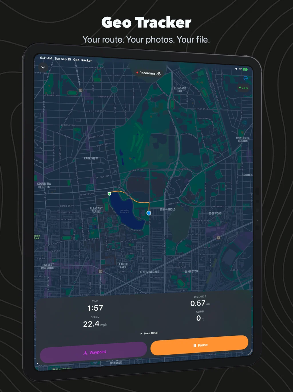
Choose a walk, hike, run or ride and tap Start Recording. Distance, time, pace or speed, and climb sit below the map while an orange line follows your route. Lock the screen and the recording continues. Stop for a coffee, pause, then resume when you leave. Turn on auto-pause to handle the stops for you; an optional idle reminder helps you remember to finish when you get home.
A photo, right where it happened
The view from the bridge, a turn you want to remember, the place you stopped for lunch: take a photo in Geo Tracker and it becomes a waypoint on the route. The camera is also available from the Lock Screen. Already took the photos? Add them afterwards and their capture times place them along the track. Share Track with Photos puts the GPX and its pictures in one ZIP, with the links kept together.
Pause from your wrist
Leave the phone in your pocket and use the recording controls on your paired Apple Watch: pause, resume, or stop and save. On the iPhone, the same recording appears on the Lock Screen and, on supported models, in the Dynamic Island. The phone records the GPS track; the Watch gives you the controls.
Follow your own line back
At the far end of a walk, open Retrace Route. Your recorded line, current position and starting point stay on the map while recording continues. You can see which turn you took on the way out and follow that same line home.
Open a track. See the whole outing.
Your recordings join the GPX files you open from Files, Mail or AirDrop in one library. Open a track to see its route, elevation profile and statistics. Rename it, share the GPX, export KML, or save a recording to Apple Health as a workout with its route.
On iPad
Open the route on a larger map, read the elevation profile and browse your saved tracks. The iPad also records with a location source available. On both devices, larger accessibility text puts the recording controls first, and you can choose kilometres or miles, metres or feet.
Try the route in the screenshots
Download the McMillan Reservoir GPX and open it in Geo Tracker. It is a three-kilometre route in Washington, DC, with an elevation profile to explore.
Yours stays yours
Routes and waypoint photos are files saved on your device. Apple Maps supplies the map; saving to Apple Health and sharing a file are choices you make. The app is available in English, German, French, Spanish and Japanese.
Questions people ask
Do I need an Apple Watch? No. Your iPhone records the route on its own. A paired Watch adds convenient controls for that recording.
Does it keep recording with the screen locked? Yes. Start the recording in Geo Tracker, then lock the screen. You can pause or finish from the Lock Screen.
How do I send someone the route and photos? Choose Share Track with Photos. It makes a ZIP containing the GPX and its linked images. Unzip the folder before opening the GPX, and keep the photos beside it.
Does it give directions back to the start? Retrace Route shows the path you recorded and your position on it. It does not provide turn-by-turn directions or downloaded offline maps.
What changed lately? Read the Geo Tracker 3 release post.