KML Explore
Open a KML or KMZ. See the map, layer by layer.
A KML file is a map someone made: folders of placemarks, paths and areas, each with its own pin, colors and lines, a description, a table of attributes, sometimes a picture laid on the ground or a legend on the screen. KML Explore opens it on your Mac, iPhone or iPad with its folders, placemarks, styles and descriptions: every folder a layer you can show or hide, each placemark drawn with the colors, lines and icons the file gives it, and for each one its description, its attributes and its measurements. It repairs common file errors and tells you what it fixed. And when the map needs changing, KML Explore edits it right on the map, and saving keeps the file’s other KML, including extensions it doesn’t edit.
Mac, iPad, iPhone
Free to view, with no account and no ads. Editing and export are KML Explore Pro, one purchase in the app for your Mac, iPhone and iPad.
See it in action
Recorded in the app. Interface shown in English.
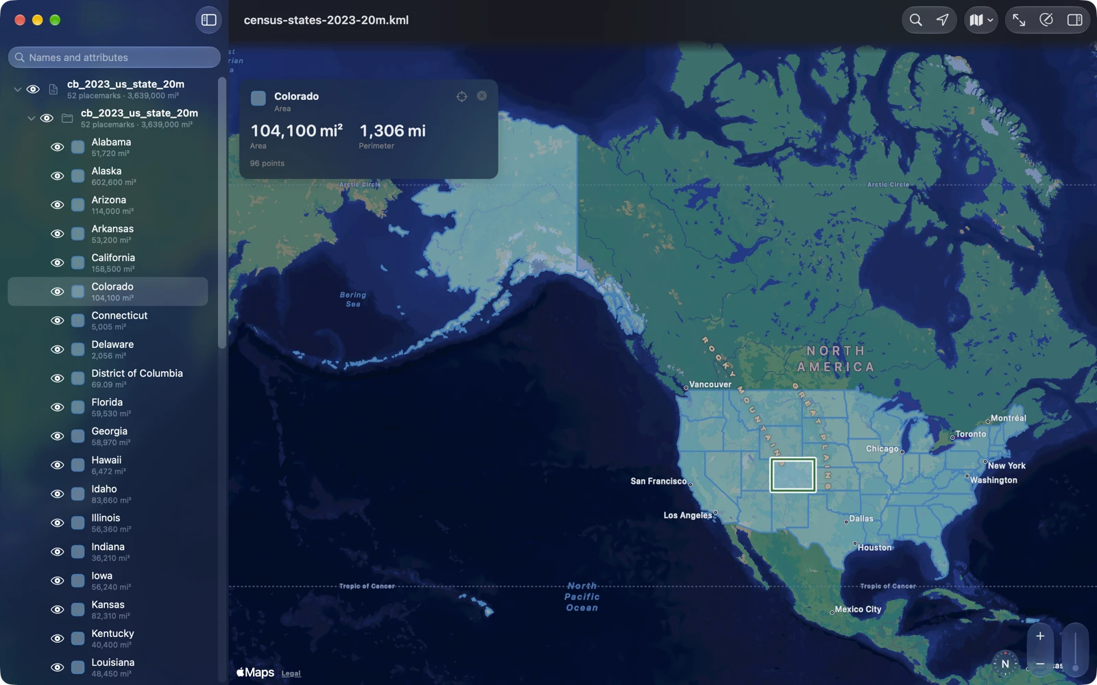
Layers you can show or hide
The layer list is the file’s own folders, in the file’s order. Each row carries the feature’s own swatch, its pin, its line or its fill, and a second line that says how much: the area, the length, the position, or how many are inside. The eye on each row works the way KML’s own switches do. Turn a folder off and everything in it goes; turn on one placemark inside a hidden folder and it shows alone, with the folders above it lit. Radio folders keep one child at a time, and folders open as the file says. Show Only This turns everything else off, and Show Everything Inside turns a whole folder on.
Placemarks are drawn with the file’s styles: the standard pushpins and paddles in the file’s colors and sizes, line colors and widths, fills, and names under the pins, as many as fit. Images laid on the ground sit where the file puts them, and legends and logos fixed to the screen sit where it places them. Six map styles, from Muted to Hybrid 3D, go under all of it. Network links, tours and 3D models stay in the file; KML Explore doesn’t load or play them.
Looking never changes the file. KML Explore remembers on your device how you left each file’s layers, and Show the File’s Layers puts back what the file says. When you want everyone who opens the file to see the same layers, Map ▸ Save Shown Layers to the File writes them in, with Pro, and Undo takes it back.
Every placemark, read
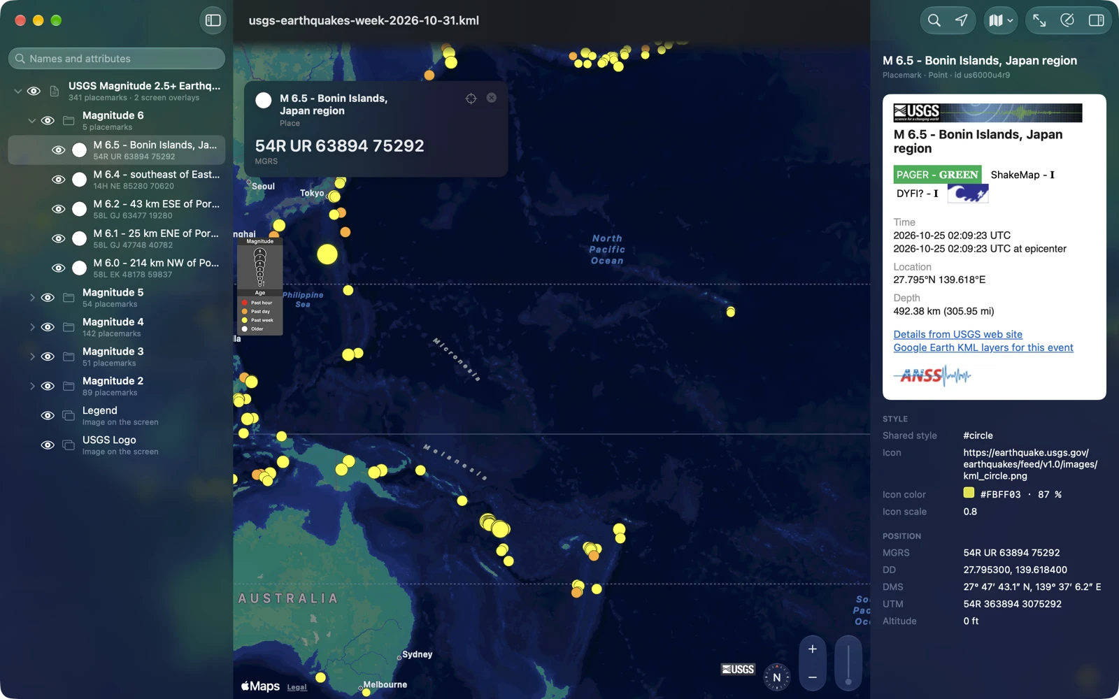
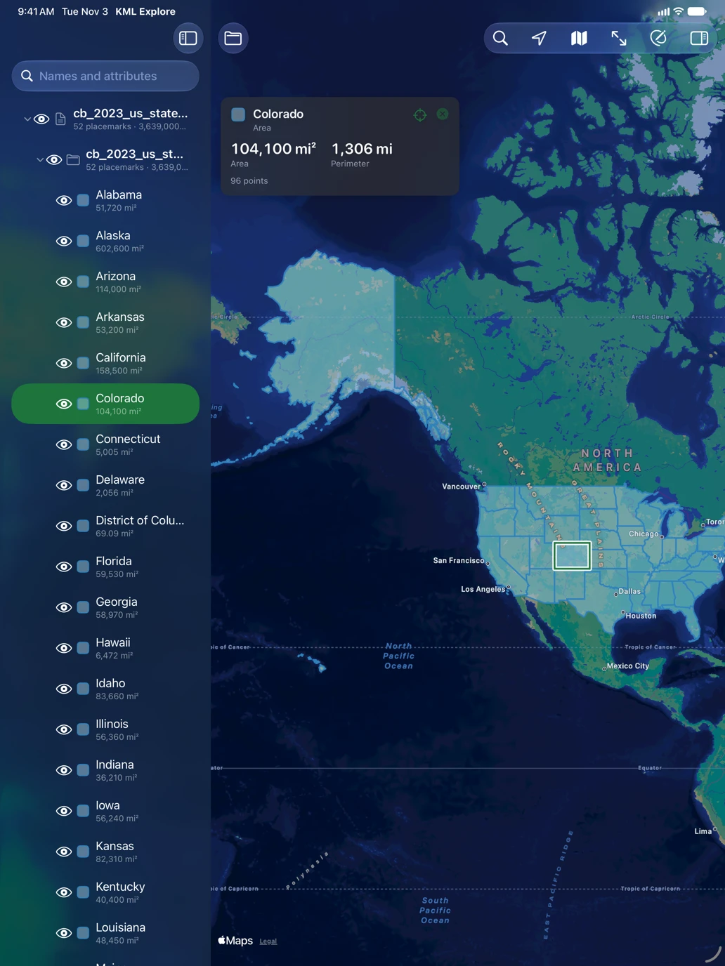
Select a placemark on the map or in the list and the inspector opens with its description as the file writes it: formatted text with its pictures and links, a balloon template filled in with the placemark’s own fields, pictures packed inside a KMZ. Links open in your browser, and scripts in a description never run. Under it are the placemark’s attributes, field by field, its time, its style and its position. The card over the map gives the numbers in large type: an area and its perimeter, a path’s length, a point’s position, a folder’s count.
Files that went through a converter on the way read cleanly too. The Census Bureau’s boundary files write every name as <at><openparen>Colorado<closeparen>; KML Explore shows Colorado, the inspector shows what the file writes, and the file’s own text is kept for when it is saved.
Search the layer list
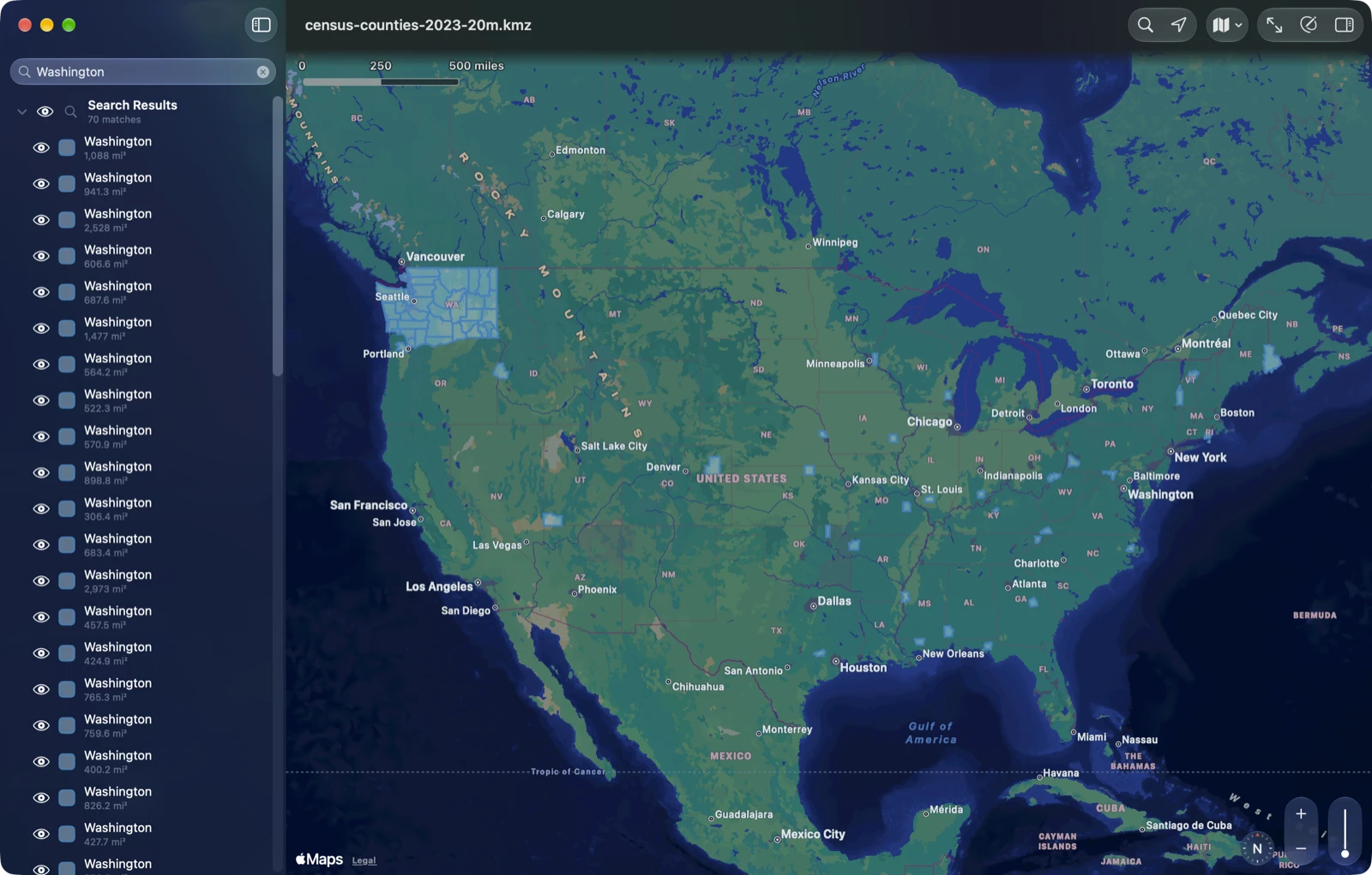
Type in the layer list’s search field and it looks through placemark names and attribute values. In the Census Bureau’s counties, Washington finds 70: the 31 counties named Washington across the country, and the 39 counties of Washington State, found by the state’s name among their attributes. The list becomes one group, Search Results, and the map shows only what matched, framed, each match with an eye of its own. Your own switches are left alone and come back when you clear the search; Keep Only These Shown makes the results your layers instead.
Areas, lengths and positions
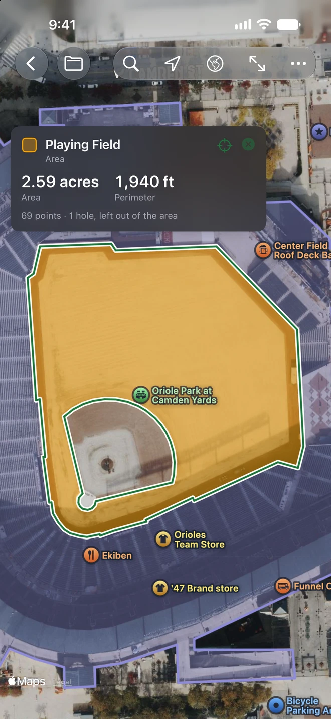
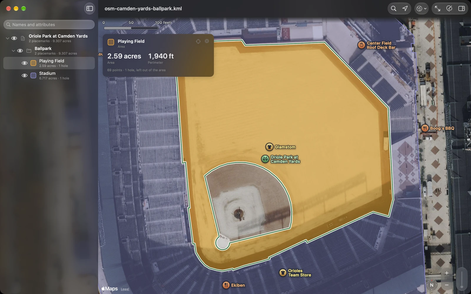
Areas are measured with their holes subtracted: the playing field at Camden Yards, from OpenStreetMap, is 2.59 acres without its infield. Areas come in acres, hectares, square meters, square kilometers, square feet, square yards, square miles, ares or tsubo, and lengths in meters, kilometers, feet, yards, miles or nautical miles: set them in Settings, or choose an area or a length on the map’s card to change its unit. Positions read in decimal degrees, degrees and decimal minutes, degrees, minutes and seconds, UTM or MGRS, on the card and in the layer list, and the inspector shows a position in several of them at once.
See where you are against it
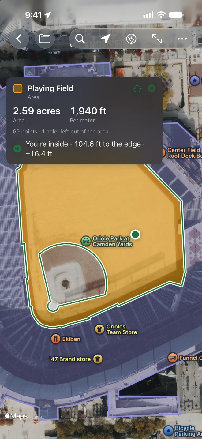
Tap the location arrow and your position joins the map. With a placemark selected, the card says how far away it is and in which direction, to its nearest point. For an area it says whether you are inside it and how far it is to the edge (a hole counts as outside), with the accuracy of the fix, and a button for directions in Apple Maps. A file’s lines are only as exact as whoever drew them, so treat them as a map, not a survey. KML Explore asks for your location when you first turn it on, and your position never leaves your device.
Find a Place goes anywhere by name or address, with Apple Maps’ suggestions as you type, or by a coordinate typed in any of the five formats, an MGRS reference included. With Pro, the place it finds becomes a placemark in one tap.
Repairs common file errors
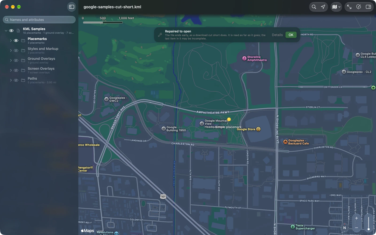
KML is written by all kinds of programs, by hand, by spreadsheets and by mail programs, and some of it isn’t quite valid. KML with common export errors, and some downloads cut short, opens anyway: KML Explore repairs a copy, opens that, and tells you what it repaired in a note over the map, Repaired to open, whose Details list each repair. Among the errors it repairs:
- an “&” that wasn’t written as &, and HTML entities like ;
- characters in Windows Latin 1 in a file that says it is UTF-8;
- text before the XML begins, and characters XML doesn’t allow;
- HTML pasted straight into a description;
- a namespace used without being declared;
- a KMZ whose map isn’t named .kml, or whose paths were written on Windows.
Viewing leaves the original file unchanged; editing saves the repaired version. If a file can’t be opened, KML Explore explains why: for broken XML, the line and column where it breaks; otherwise what the file really is, such as a web page saved under a KML name (the link needed a sign-in, or no longer leads to the file), a GPX or GeoJSON file, or an empty one.
Quick Look, before you open anything
Press the space bar on a KML or KMZ in the Finder on the Mac, or open one in Files on iPhone and iPad, and Quick Look shows its map: the file’s areas, paths and places as the file shows them, with a scale and a list of what is in it and how big. The Finder and Files give each file its own picture as its icon too. Both are drawn on your device from the file alone, on a small map of the world, or plain paper close in: no map tiles, no server, nothing from the web.
Edit the map
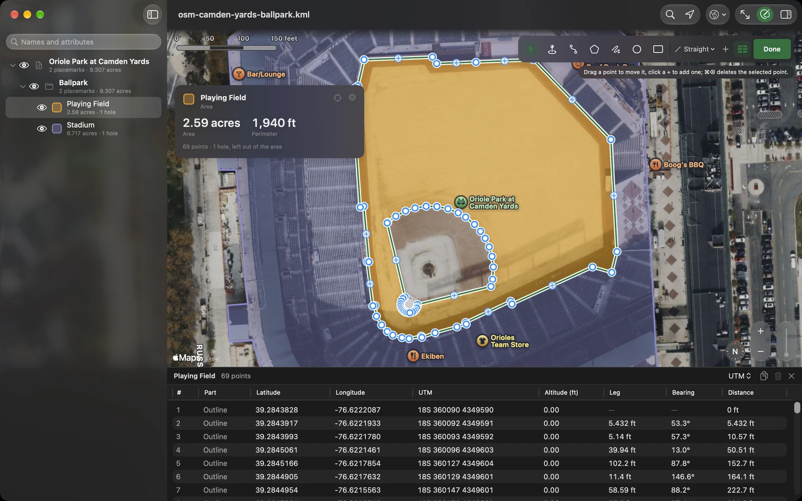
With KML Explore Pro, press Edit and draw placemarks, paths, areas, circles and rectangles. Paths and area outlines go straight from point to point, or follow paths and roads for walking, cycling or driving, with Apple Maps working out each leg; or draw them freehand. Drag any point, with a loupe that shows where it lands; add one on the + between two; delete one from its callout; cut a hole in an area.
For exact work, the Points table lists every point of the selected placemark with its latitude, longitude and altitude, the leg, the bearing and the distance along. Enter coordinates to seven decimal places, in the table’s cells on the Mac or with Edit Point on iPhone and iPad; nudge a point north, south, east or west by 10 centimeters, 1 meter or 10 meters (1, 10 or 100 feet); pick several rows and delete them at once. Simplify thins a path to the points it needs, with the count shown as you go; Reverse turns it around; Make an Area closes a path into an area, and Make a Path turns an area back into its outline.
The inspector edits what the file says about each placemark: its name and description, its attributes (added, renamed or removed), its style for this placemark alone or for every placemark that shares it (colors, line widths, the standard icons), and its height: on the ground, above it or above sea level, extended to the ground if you like. Folders are made, renamed, duplicated and deleted in the layer list, and anything can be dragged into another. Every change is one step of undo.
The rest of the file stays
A KML can hold more than KML Explore draws: network links, tours, 3D models, another program’s own extensions. KML Explore keeps the file as its tree of elements, and the map, the layer list and the editor are views of that tree. An edit changes the elements it touches, and saving keeps the file’s other KML, including extensions KML Explore doesn’t edit. A file you only look at is never rewritten. We check this on every sample file with random edits of every kind, undone and redone, each compared with the file read again from scratch; undoing everything has to give back the tree that was opened.
Export as GPX, GeoJSON or CSV
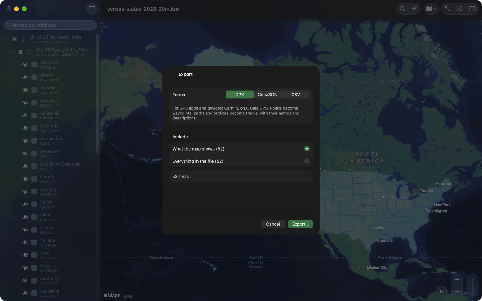
With Pro, File ▸ Export… writes waypoints and tracks as GPX for GPS apps and devices, shapes with their attributes as GeoJSON for web maps and QGIS, or placemarks with their attributes and measurements as CSV for a spreadsheet: what the map shows, all of the file’s placemarks, or the selected folder. Your KML stays as it is; the export is a copy. We read every sample’s export back with GDAL, gpxpy and shapely, and checked every GPX against the GPX schema.
Made for the Mac
Double-click a .kml or .kmz and it opens in a window of its own; open several and each gets one. The welcome window has Open a File…, New Map, the six sample files and your recent files, and takes a file dropped on it. The Draw menu has every tool, and the keyboard covers the rest: ⌥⌘E to edit, ⌃⌘1 to ⌃⌘7 for the tools, ⌥⌘P for the Points table, ⌥ and an arrow key to nudge a point, ⇧⌘N for a new folder, ⌘F to find a place, ⇧⌘E to export, ⇧⌘0 for the welcome window. Settings (⌘,) has General, Map and Privacy tabs.
Made for iPhone and iPad
On iPhone and iPad, KML Explore opens to a start screen: Open a KML or KMZ File…, New Map, the six samples, and your recent files, each with a small picture of its map. Documents open in place from Files and iCloud Drive, and once you edit one it saves itself as you go, in its own format, KML or KMZ; copies received through Mail, Messages and AirDrop are kept in KML Explore’s own folder. The File menu has New Map, Open, Save, Share and Settings. On iPhone the inspector comes up as a sheet, and so does the Points table when you open it while editing; on iPad the layer list and the inspector sit beside the map.
No file handy? Try these
Real files, free to use: the six KML Explore has built in, and the ballpark in the pictures above. Download one, then open it with KML Explore.
- Google’s KML samples: placemarks, paths, buildings and overlays from Google’s KML reference. CC BY 4.0, Google.
- Oriole Park at Camden Yards: the playing field with the infield cut out, and the stands with the field cut out, from OpenStreetMap. © OpenStreetMap contributors, ODbL.
- US states: the Census Bureau’s 2023 state boundaries with their attributes.
- US counties: the Census Bureau’s 3,222 counties in one KMZ.
- A week of earthquakes: the USGS feed of magnitude 2.5 and up for the week to October 31, 2026, with its legend.
- Fires in a day: NASA’s satellite fire detections over the US for 24 hours to October 31, 2026.
- Storm outlook: NOAA’s Storm Prediction Center outlook of severe weather risk for a day, a small KMZ.
Yours stays yours
No account, no ads, no tracking. KML Explore works on your files on your device and doesn’t upload them; files you keep in iCloud Drive sync through iCloud. The map comes from Apple Maps. Opening a file reaches nothing the file names: icons, images and pictures in descriptions that a file links to on the web wait until you choose Load for that file, or turn on Load Images from the Web in Settings ▸ Privacy, so a file from someone else can’t make the app contact a server just by being opened. Network links in a file are listed, not fetched, and scripts in descriptions never run. Find a Place asks Apple Maps, and so do paths and outlines drawn along roads. Your location, when you turn it on, stays on your device, and Quick Look draws its pictures from the file alone.
Questions people ask
How do I open a KML or KMZ file on a Mac? Install KML Explore from the Mac App Store and double-click the file. If another app opens .kml files, right-click the file, choose Get Info, pick KML Explore under Open With and click Change All.
How do I open a KMZ on iPhone or iPad? Open KML Explore and choose Open a KML or KMZ File… on the start screen, or share the file to KML Explore from Mail, Messages or Files.
What is the difference between KML and KMZ? A KMZ is a KML zipped together with the pictures and icons it uses. KML Explore opens both, shows the pictures from inside a KMZ, and saves a KMZ as KMZ and a KML as KML.
Does it open files from Google Earth and My Maps? Yes, and files from GIS software, county and state portals and the agencies that publish KML: KML 2.0 to 2.3, with or without the gx: extensions. Network links, tours and 3D models stay in the file, but KML Explore doesn’t load or play them.
Does it measure acres? Yes, and hectares, square feet, square miles and five more, with holes subtracted from an area. Lengths and perimeters come in meters, kilometers, feet, yards, miles or nautical miles.
Does it show UTM and MGRS coordinates? Yes, beside decimal degrees, degrees and decimal minutes, and degrees, minutes and seconds. You can type a position in any of them in Find a Place, and, while editing, in the Points table on the Mac or in Edit Point on iPhone and iPad.
Can it edit KML files? Yes, with KML Explore Pro, on the Mac, iPhone and iPad: draw placemarks, paths, areas, circles and rectangles, move, add and delete points, cut holes, and change names, descriptions, attributes, styles, heights and folders. Every change can be undone, and saving keeps the file’s other KML, including extensions KML Explore doesn’t edit.
Can it convert KML to GPX, GeoJSON or CSV? Yes, with Pro: File ▸ Export… writes waypoints and tracks as GPX, shapes with their attributes as GeoJSON, and placemarks with their attributes and measurements as CSV. The KML stays as it is; the export is a copy.
A file says Repaired to open. What happened? The file had errors that stop a strict reader, so KML Explore repaired a copy to open it, and Details lists each repair. Viewing leaves the original file unchanged; editing saves the repaired version.
Is it free? Viewing is free: the layers, descriptions, attributes, measurements, search, coordinates, Find a Place, My Location and Quick Look. Editing, New Map, saving which layers are shown, and export are KML Explore Pro, a one-time purchase in the app with no subscription, for your Mac, iPhone and iPad, and shared with your family through Family Sharing.
What does it run on? A Mac with macOS 15.4 or later, and iPhone and iPad with iOS and iPadOS 18 or later.
Version 1.0 is the first: the launch post says why it exists and what it does first.