Geo Marker
Know your grid. Walk to the next one.
Geo Marker is a land navigation app for people who work from a gridded map: soldiers in training, search and rescue teams, hunters and hikers. It shows where you stand as an MGRS grid in large type, points an arrow at any mark you type in, and does the map-and-compass problems you would otherwise work on paper. Your grid, your marks and the arrow come from GPS alone, with no signal.
iPad, iPhone
Your grid, at a glance
The Position screen is the one you look at most, so it is built to be read at arm’s length. The MGRS grid is in large type, with UTM, latitude and longitude or a Plus Code beside it. A bar across the top of every screen shows the accuracy GPS reports, in meters. Below the grid: your heading in degrees or mils, from true, magnetic or grid north, with the declination and the grid convergence as numbers; altitude; speed; and the date-time group, local and Zulu. You choose which panels are shown and in what order. One tap turns the screen red on black for the night.
The grid on the map
The Map tab draws the grid lines over the map and labels them, from 100 km squares down to 100 m as you zoom in. The crosshair in the middle reads the grid under it. The card at the bottom is a ruler: the distance, azimuth and back azimuth from you to the crosshair, or from any mark. Standard, satellite and hybrid maps, and the marks of a folder are joined in order as a course.
Type a grid in seconds
Somebody reads you a grid over the radio. On Marks, press + and type the digits on a keypad made for it: easting first, then northing. The zone and the 100 km square are remembered from where you are, so most of the time you type only 6, 8 or 10 digits. You can also mark where you stand, mark the crosshair, or project a point so many meters along an azimuth from where you stand. Pasted coordinates are read in MGRS, UTM, latitude and longitude or as a Plus Code.
Each mark has a name, a symbol and a note. A folder holds the marks of one course or one job. Import and export GPX, KML, GeoJSON and CSV.
Go To: the arrow, the distance, your paces
Tap a mark and Go To shows an arrow toward it, the distance, the azimuth and its back azimuth, the paces left from your own pace count, and how far you have drifted left or right of the straight line. A folder is a course: reach one mark and the next leg is a tap away.
The tools you would work on paper
- Resection. Sight on two or three marks you can see, or type the azimuths from your compass, and Geo Marker finds where you are. It needs no GPS. It also tells you how well the lines agree, which is the honest measure of the answer.
- Intersection. Find a distant point from the azimuths read at two marks.
- Grid, magnetic, true. Convert an azimuth from one north to another: map to compass and back.
- Pace count. Walk a measured 100 meters and count. Go To uses your number.
With no signal
The grid comes from GPS, and GPS needs no cell coverage. Your marks, Go To and the tools all work in airplane mode. The one thing that needs a connection is the map’s pictures: the grid lines, the crosshair and your marks still draw without them.
On iPad and iPhone Duo
On an iPad and on an open iPhone Duo, Geo Marker shows two pages at once: the screen you are on and the map.
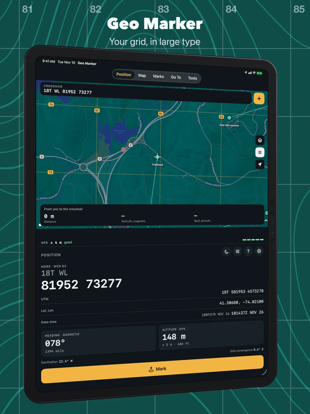
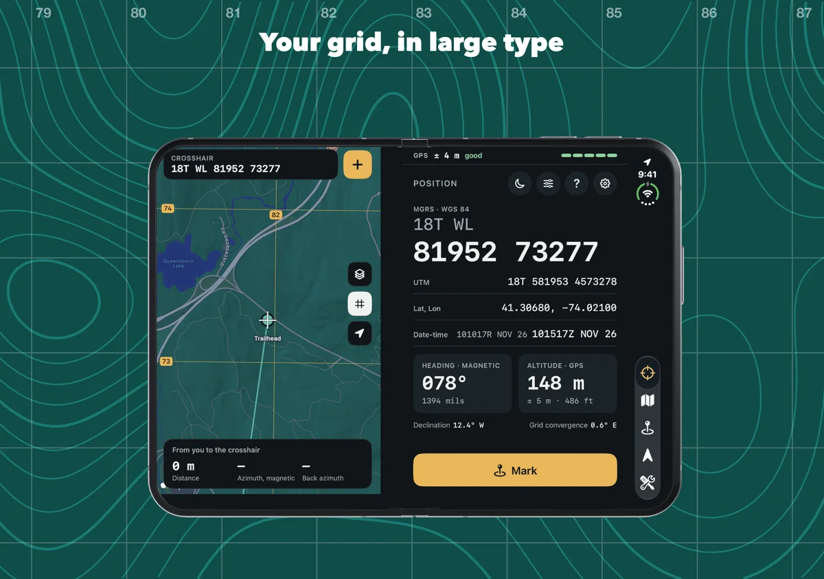
Try the course in the screenshots
Download the Bear Mountain course (KML, five marks in one folder) and open the Marks tab. From the menu, choose Import GPX, KML, CSV… and pick the file. The marks arrive in a folder called Bear Mtn course, in walking order: tap the first one and Go To shows the leg. The course is in Bear Mountain State Park, New York.
Numbers you can check
Grids are MGRS on WGS 84, the datum of GPS and of current maps. An older paper map on NAD 27 has its grid about 200 meters away from this one: check the map’s margin. Every position is shown with the accuracy GPS reported for it, and a grid you typed keeps the precision you typed. The grid math is tested against reference values from PROJ and NGA GeoTrans.
A phone is an aid, not a certified instrument. Its compass is good to a few degrees, and batteries run out. Carry your map and compass.
Yours stays yours
Geo Marker has no account, no ads and no tracking. Your location is used only while you use the app. Your marks stay on your device, and in your own iCloud if you turn sync on. Ground height lookup is off until you turn it on in Settings; then your position goes to our elevation server, which gets only the coordinates. The app is in English, German, French, Spanish and Japanese.
Questions people ask
Does it work without cell service? Yes. The grid, marks, Go To and the tools need only GPS. The map’s pictures need a connection.
Does it have offline maps? No. Without a connection the map shows the grid lines, the crosshair and your marks over a blank ground.
Which formats does it show? MGRS, UTM, latitude and longitude (decimal degrees, degrees and minutes, or degrees, minutes and seconds) and Plus Codes, all on WGS 84.
Degrees or mils? Which north? Both. Settings chooses degrees or mils (6400), and true, magnetic or grid north. Every azimuth on screen says which north it is from.
How accurate is it? As accurate as the phone’s GPS, and it says how accurate that is: the ± at the top of every screen is the figure the phone reports. Under open sky that is usually a few meters; under trees or beside a cliff it is more.
How can I check it? Stand at a spot you can find on a map and compare. The guide’s accuracy page has a twenty-minute check of the position, the grid, distances, azimuths and resection.
Is it an official military app? No. ObjectGraph makes it independently. It is an aid for training and for the outdoors, and it does not replace issued equipment, a map or a compass.
Is there a guide? The Geo Marker guide covers every screen, tool and setting.
What is new? Read the Geo Marker 3 post.