Geo Marker 3: a land navigation app, on a record from 2009
Geo Marker was one of the first apps I put on the App Store, in June 2009. It showed your latitude and longitude and the address of where you stood. Version 3 keeps the name and changes the job: it is now a land navigation app, for people who work from a map with a grid on it.
Why this
Our map apps measure, record and edit. None of them answered the plainest question a person with a paper map has: what is my grid, and which way is the next point? Soldiers in training, search and rescue teams, hunters and hikers who learned on a military map all work in MGRS, with azimuths and pace counts. That is a small, exact craft, and I wanted an app that does it the way the craft is taught.
What it does
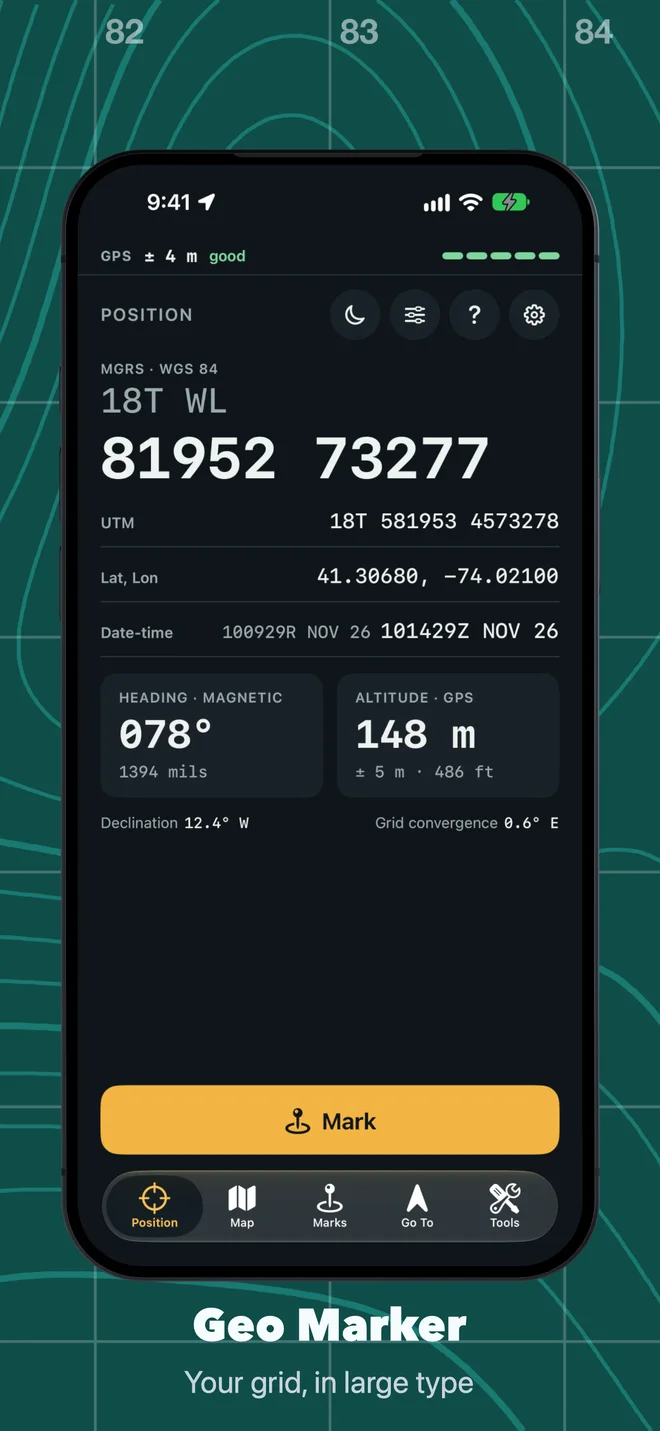
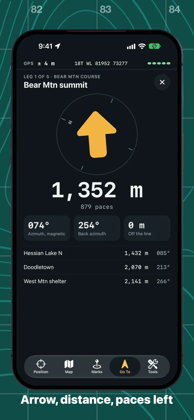
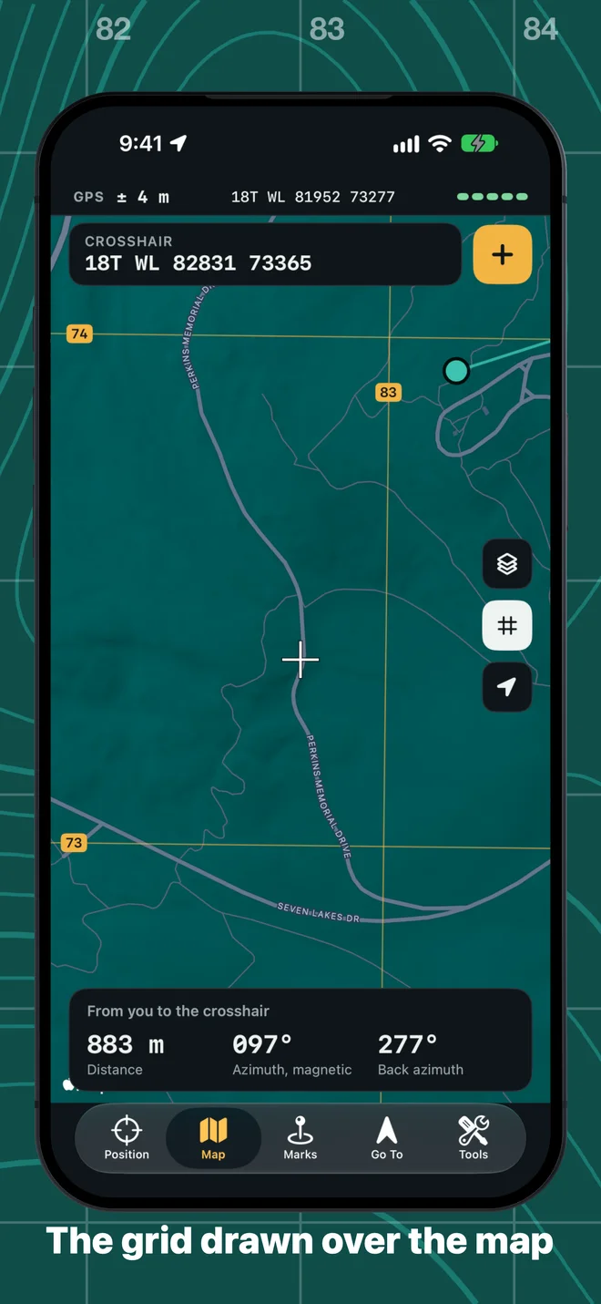
Position shows your grid in type you can read at arm’s length, with the accuracy GPS reports for it, your heading in degrees or mils, and the date-time group. Map draws the grid over the map and gives you a crosshair and a ruler. Marks takes a grid typed on a keypad made for it: the zone and square are remembered, so you type the digits and nothing else. Go To is an arrow, a distance, an azimuth and its back azimuth, the paces left from your own pace count, and how far you have drifted off the straight line. Tools does resection, intersection, the conversion between grid, magnetic and true north, and a walk that measures your pace count.
All of that works from GPS alone. Only the map’s pictures need a connection.
Getting the numbers right
An app like this is only worth having if its numbers are right, so most of the work went there. The grid math is tested against reference values from PROJ and NGA GeoTrans. A grid azimuth becomes a magnetic one by the declination and the grid convergence where you stand, and the app shows both. Every azimuth on screen says which north it is from. A position always carries the accuracy the phone reported, and when the phone has moved the app does not keep showing an old fix with a confident number beside it.
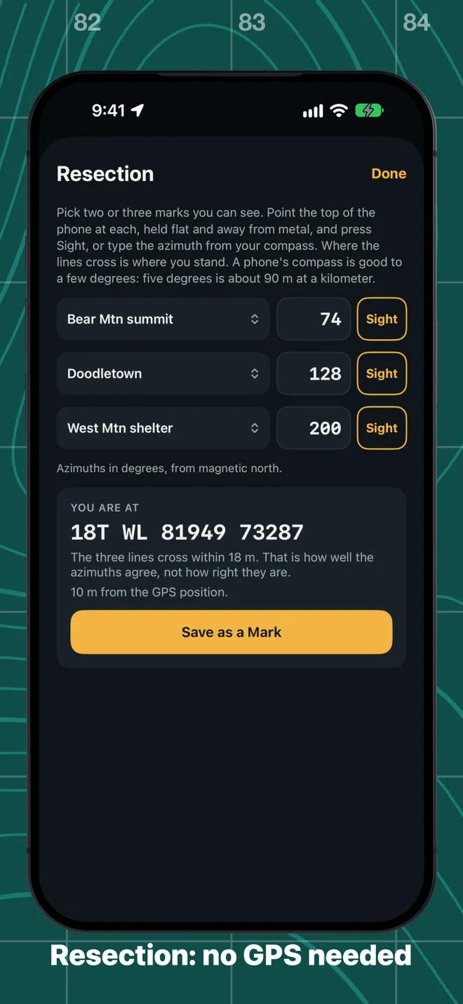
Resection is the tool I like most. Sight on two or three marks you can see, or type the azimuths from your compass, and it finds where you are with no GPS at all. It also tells you how well the lines agree, and says plainly that agreement is not the same as being right.
A phone is an aid, not a certified instrument. Its compass is good to a few degrees and its battery runs out. The app says so, and so do I: carry your map and compass.
What it does not do yet
There are no offline maps in this version. Without a connection you still have the grid lines, the crosshair and your marks, over a blank ground.
Private
No account, no ads, no tracking. Your location is used only while you use the app. Marks stay on your device, and in your own iCloud if you turn sync on. The app is in English, German, French, Spanish and Japanese, on iPhone and iPad.
More on the Geo Marker page, and every screen and tool is in the guide.