GPX Explore 2.1: ride it, turn by turn
Since 2.0 I have drawn most of my routes in GPX Explore: click along the trail, watch the climb appear on the chart, save the file. And then, every time, the last step happened in somebody else’s app. I would export the route, import it into a bike computer or a navigation app, and hope it understood the file the way I drew it.
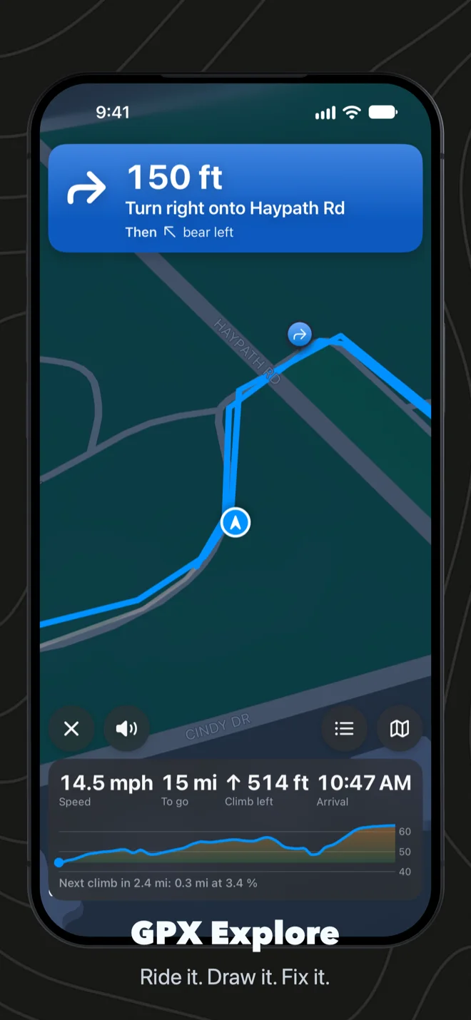
Version 2.1 does that last step itself. Open any GPX file on your iPhone or iPad, tap Ride, and GPX Explore takes you along it, turn by turn, with the street names spoken.
Turns from the shape of the route
A GPX file has no road network in it, only a line. So GPX Explore reads the line the way you would look at it on a map: where it bends hard, that is a turn; where it curves gently along a road, it is not. Then it asks Apple Maps what the streets are called on either side of each turn, so you hear “In 300 feet, turn left onto Main Street” rather than “turn left in 300 feet” and a guess. Two turns close together are said as one, “turn left, then right”, because that is how you would tell a friend.
Leave the route and you hear which side it is on and how far. One tap gets Apple Maps directions back to it, to a point a little ahead of where you left, so you never ride back to where you went wrong. Start in the middle of a route and it simply picks up from there. That last one I learned on my first real walk with it: I started halfway along an earlier walk, and an early version kept sending me to the beginning. Now it notices you are already on the route.
On a climb, the bottom of the screen becomes a climb panel: which climb of how many, its category, the grade where you are, and how far and how high it is to the top. Over the next two kilometers it shows the profile ahead, so you can see whether the steep part is behind you.
Phone in your pocket
Most of the time I do not want to look at a screen. With the screen off, the turns are still spoken, quietly over whatever you are listening to, and the next one sits on the Lock Screen and in the Dynamic Island with the distance to go. If iOS closes the app on a long ride, opening it again within half an hour carries on where you were.
It is not only for bikes. Choose run, walk or hike and the words, the arrival time and how far off the route counts as off route all change to match.
Every climb, rated
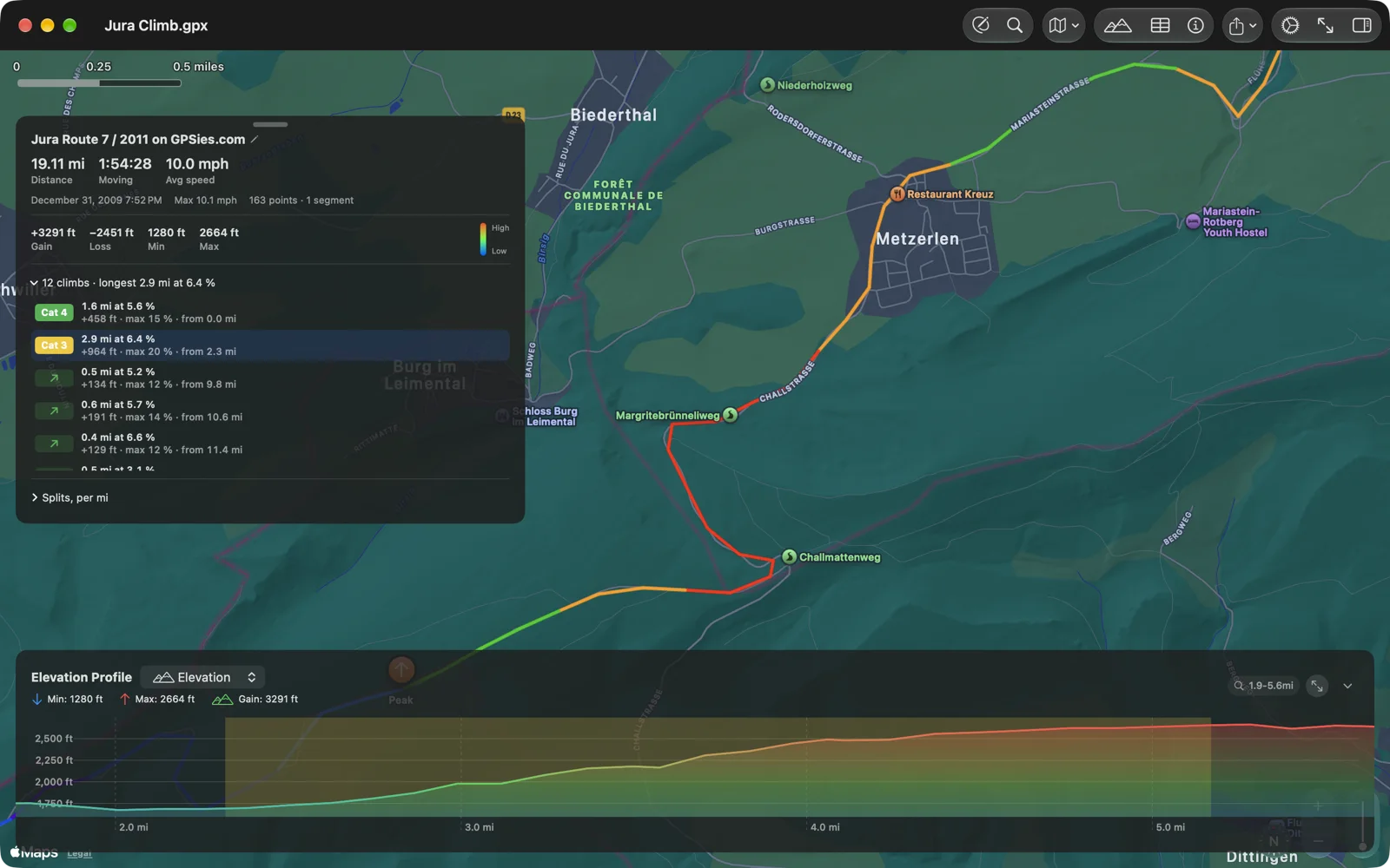
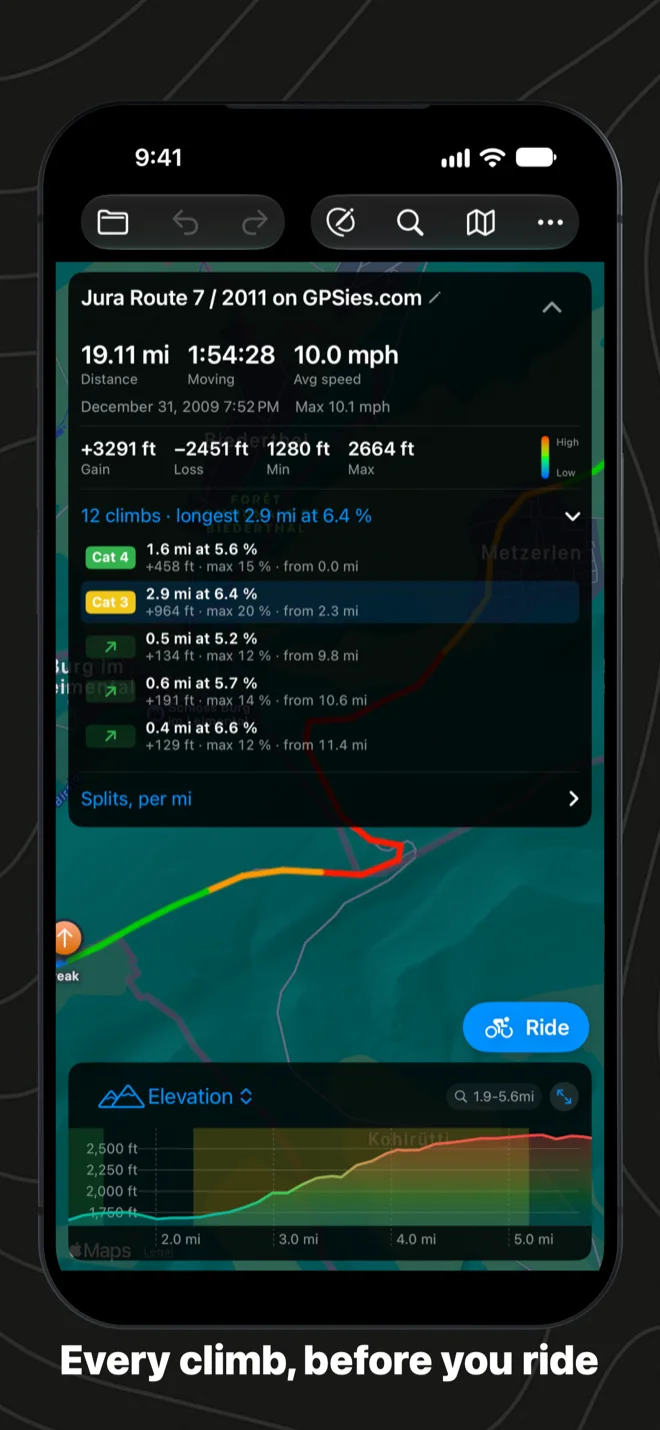
Bike computers have had this for years and I wanted it before the ride, not during it. GPX Explore now finds every climb on a track, at least 500 meters at 3 percent or a short, steep 250 meters at 7, and rates it from Category 4 to HC by its length and grade, the way Garmin does. The route card lists them, with their length, average and steepest grade and the height you gain; pick one and the chart and the map close in on it. On the elevation profile each climb is shaded in the color of its category. Above are 19 miles of the Swiss Jura: twelve climbs, one of them a Category 3 that gains almost a thousand feet. Climbs are free, on the Mac too.
The ride, kept
While you ride, GPX Explore records your track. At the end the map gives way to your ride drawn over the route, with your moving time, distance, climb and average speed, and a button to save it to Apple Health as a workout with its map, so it shows up in Fitness like any other. The GPX file is in the GPX Explore folder in Files, and in Recent Files on the start screen the next time you open the app.
Your workouts, free
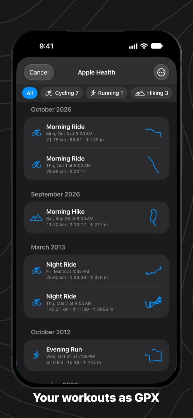
On iPhone and iPad, From Apple Health on the start screen lists every workout with a route, by month, each with the outline of where you went. Open one and it is on the map like any GPX file, heart rate, cadence and power included. Save it as GPX for Strava, Garmin Connect or Komoot, one at a time or a dozen at once. I first built this as WorkoutGPX, and it stays free here too: your own workouts should not cost anything to look at.
On the Mac
The Mac gets the climbs, and two things from Geo Elevation that I kept reaching for: the route card can be dragged anywhere on the map by its bar, and the elevation chart folds away when you want the whole window for the map.
What it costs
Viewing any GPX file is free, and so are the climbs and your Apple Health workouts. Riding turn by turn, drawing and editing are GPX Explore Pro: one purchase, no subscription, on your Mac, iPhone and iPad. If you already have Pro, 2.1 is yours.