Geo Elevation 3.0: the ground in relief
The US Geological Survey used to print relief maps you could almost touch: a mountain lit by a low sun from the northwest, every ridge throwing its shadow, the rock units in their colors, with the sections and an explanation of the rocks around the edge. The one I kept going back to while working on this release is their 1963 plate of Mount Rainier. Geo Elevation 3.0 is my attempt to make any place on Earth look like that, from real elevation data, in a few seconds.
The ground in relief
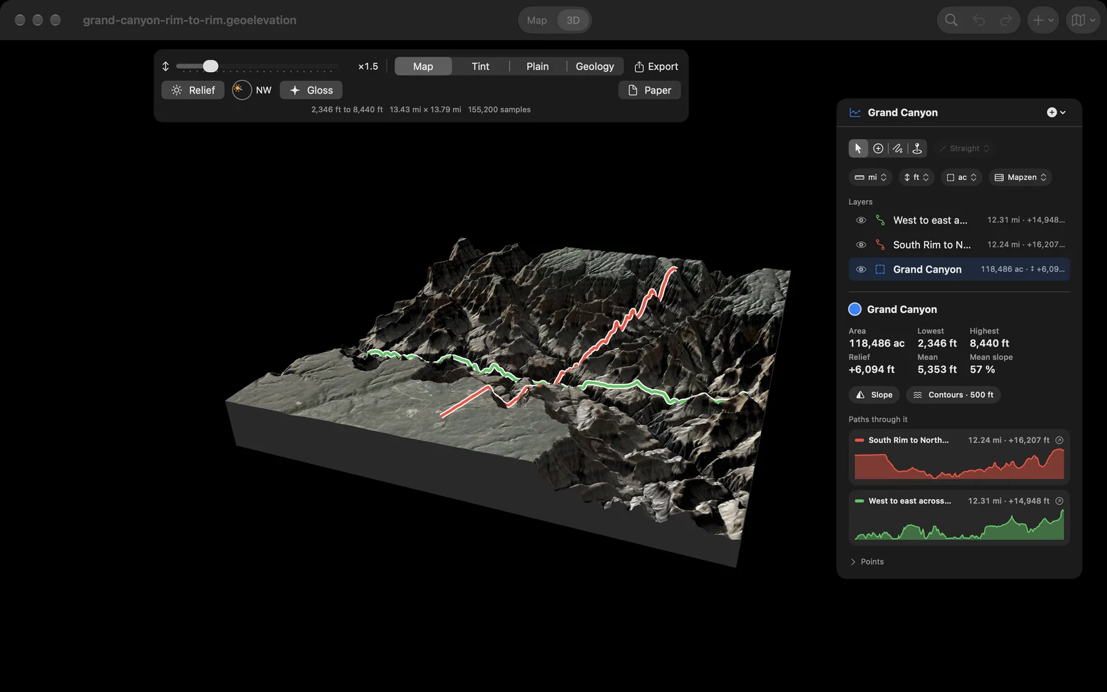
Draw an area or a circle, switch to 3D, and the ground stands up as a block, now shaded the way those plates were. A low sun you can move around a dial casts real shadows across the block, and the light of the open sky fills the valleys, so a canyon floor stays readable instead of going black. Cover the ground with the map’s imagery, a tint by height, plain paper, or its geology. Raise the heights to read a gentle hill. Turn on Gloss and the sunlit slopes catch the light like a varnished relief model.
The rocks underneath
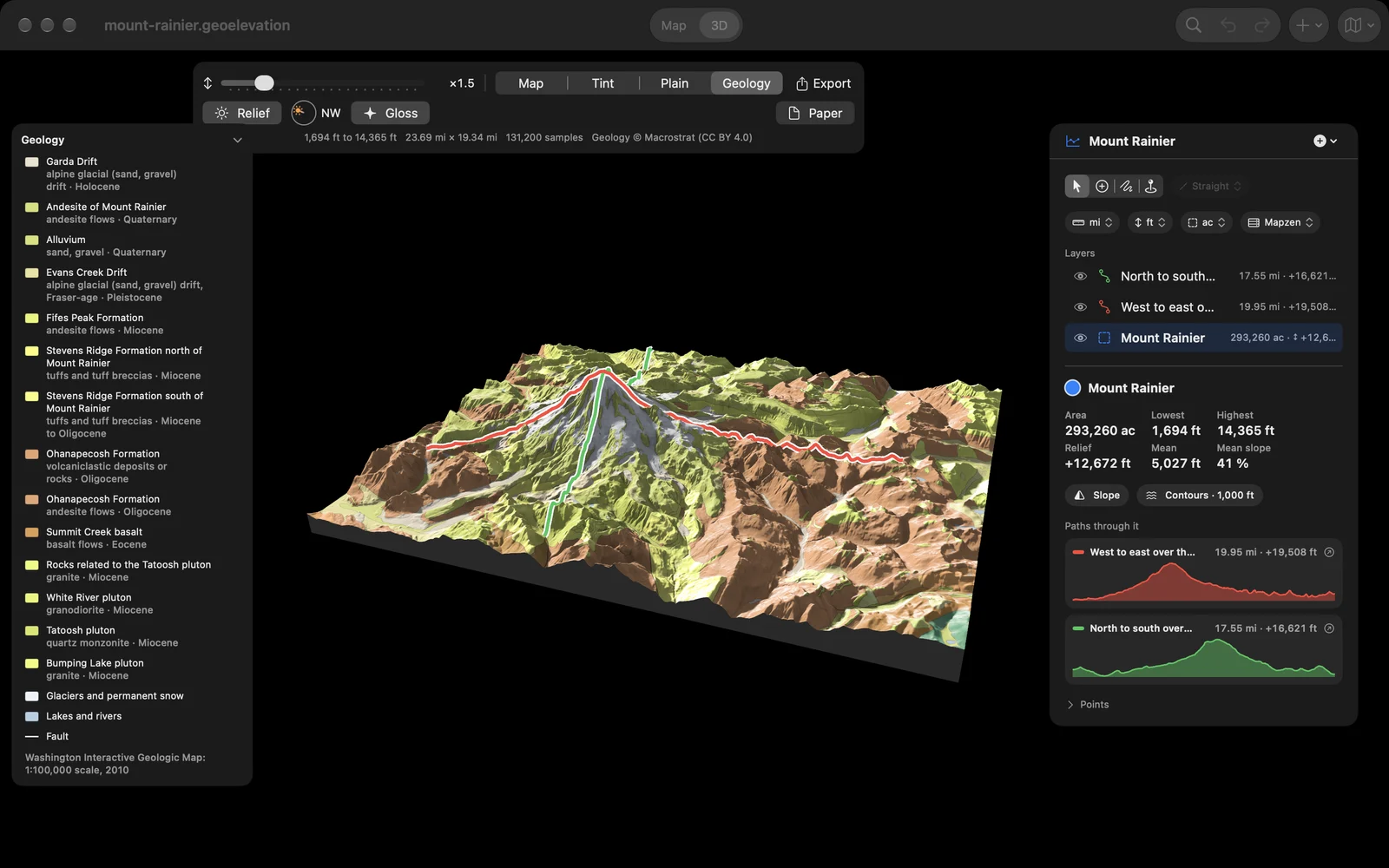
Choose Geology and the ground takes the colors of the geologic map, from Macrostrat, which gathers the geologic maps of the world into one. The legend names every unit with its rock and its age, faults are drawn as heavy lines, glaciers and lakes are marked, and the unit under the pointer is picked out in the legend. On Mount Rainier that means andesite flows on top of the older volcanic rock of the Ohanapecosh Formation and the Tatoosh pluton, with glaciers and drift all around.
A plate to print
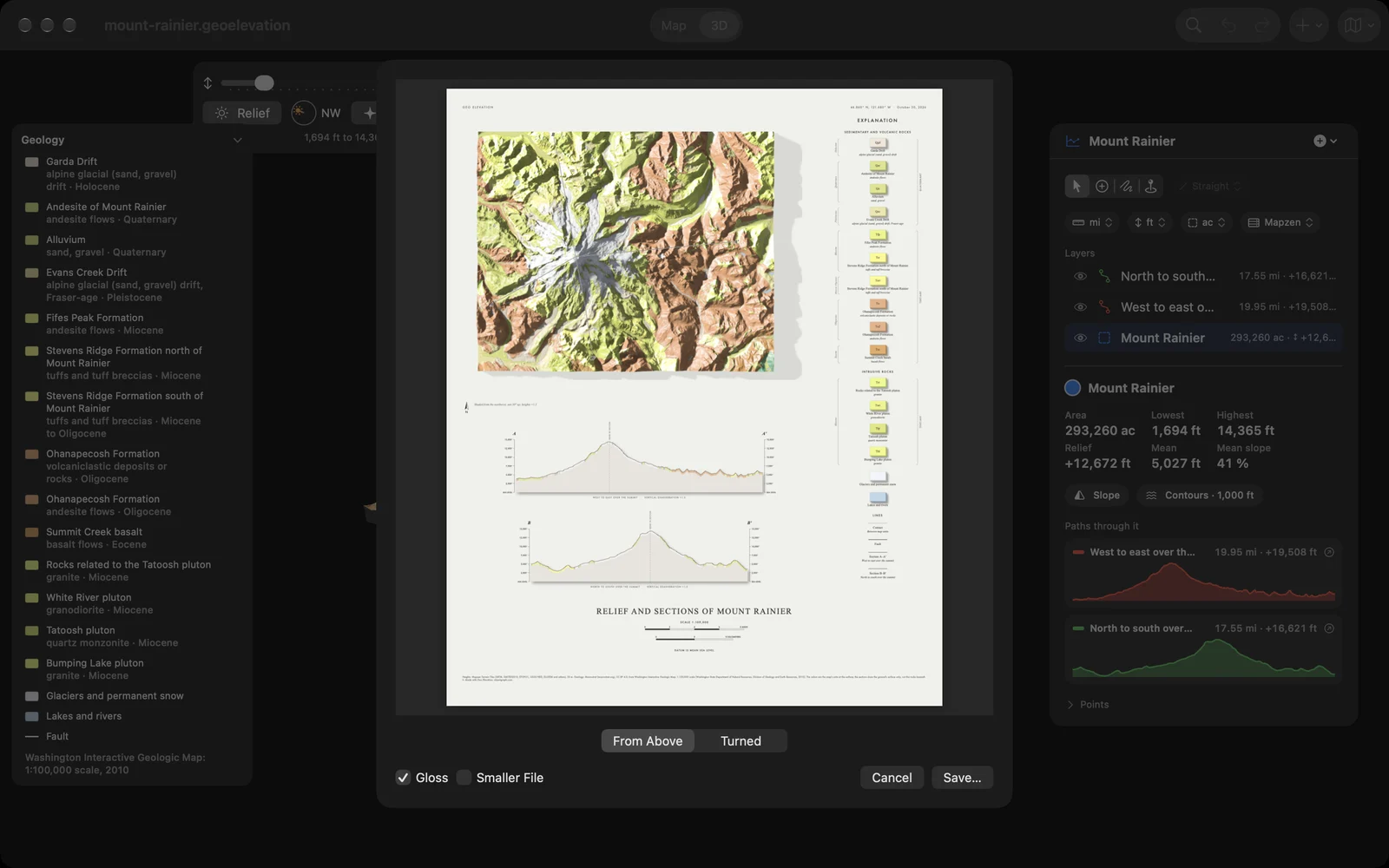
Then make the plate itself: the relief seen from above or as you turned it, a section cut along each of your paths, the explanation of the rocks and the scales, laid out on one page. A preview shows it before you save the PDF, and Smaller File keeps the pictures light when you want to send it. The 3D view also saves as a large picture or a PDF, as a 3D model for AR and Quick Look, and as a scene for Blender; the STL for 3D printing is still there.
On Apple Vision Pro
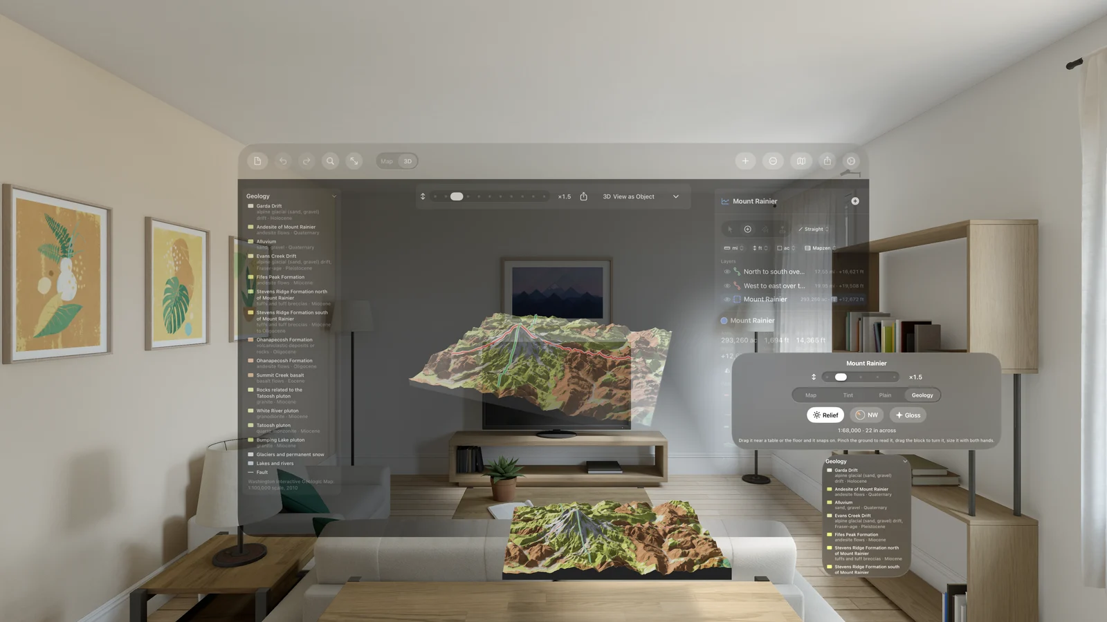
This is the part I wanted most. Choose View as Object and the block leaves the window and settles on your table or the floor, to walk around, turn with one hand and size with two. Pinch the ground to read its height. Then choose Stand Here: the block flies out into the room and opens into the land at its true size, and you are standing on the spot you pinched. Walk, turn, follow the compass, pull the land toward you. The clip above is the floor of Zion Canyon, at the Grotto, looking up the canyon.
Ten places to start
The app now opens on a start screen with ten real places, each with its paths and its ground: Mount Rainier, the Grand Canyon, Yosemite Valley, Glacier Point, Zion Canyon, Mount St. Helens, Crater Lake, Kīlauea, Mount Whitney and Mount Washington. Tap one and it opens straight into 3D. On the Mac they are a page of the welcome window.
Free, with Geo Elevation Pro
Geo Elevation is now free. Everything on the map stays free: paths, areas and circles, their profiles and heights, slope and contours, line of sight and the view from a point. Geo Elevation Pro is one purchase for iPhone, iPad, Mac and Apple Vision Pro, shared with your family, and it adds the ground in 3D, Look, Apple Vision Pro, and every export. The ten places show their 3D without it, so you can see what it does before you decide.
If you bought Geo Elevation at any time before 3.0, on any of its versions back to 2012, you don’t pay again: the App Store confirms the earlier purchase and Pro is simply on. The Mac-only edition works the same way on its own record.
And
Geo Elevation runs on iPhone Duo, open and closed, with the toolbar along the side. The new screens are in English, German, French, Spanish and Japanese. And the guide has pages for the plate, the geology, Apple Vision Pro and Geo Elevation Pro.
The Geo Elevation page has the rest, and sample files to download. If there is a place you would like to see in relief, tell me through the contact form.