Geo Elevation 2.1: read the ground, not just the line
For fourteen years Geo Elevation has answered one question: what is the ground like under this line? Version 2.0 answered it properly, a sample every 30 metres and the terrain in 3D. But the questions people actually bring to a map are bigger than a line. How steep is the whole face, not just the trail across it? Where are the slopes that matter in winter? I have two trails up this mountain; which one climbs harder, and where?
So 2.1 is built like Geo Measure. A path is one kind of shape and an area is another, a document holds as many as you like, and each one answers with what its shape can tell you. A line answers with a chart. An area answers with the ground itself.
See it in action
Recorded in the app. Interface shown in English.
A path that follows the trail
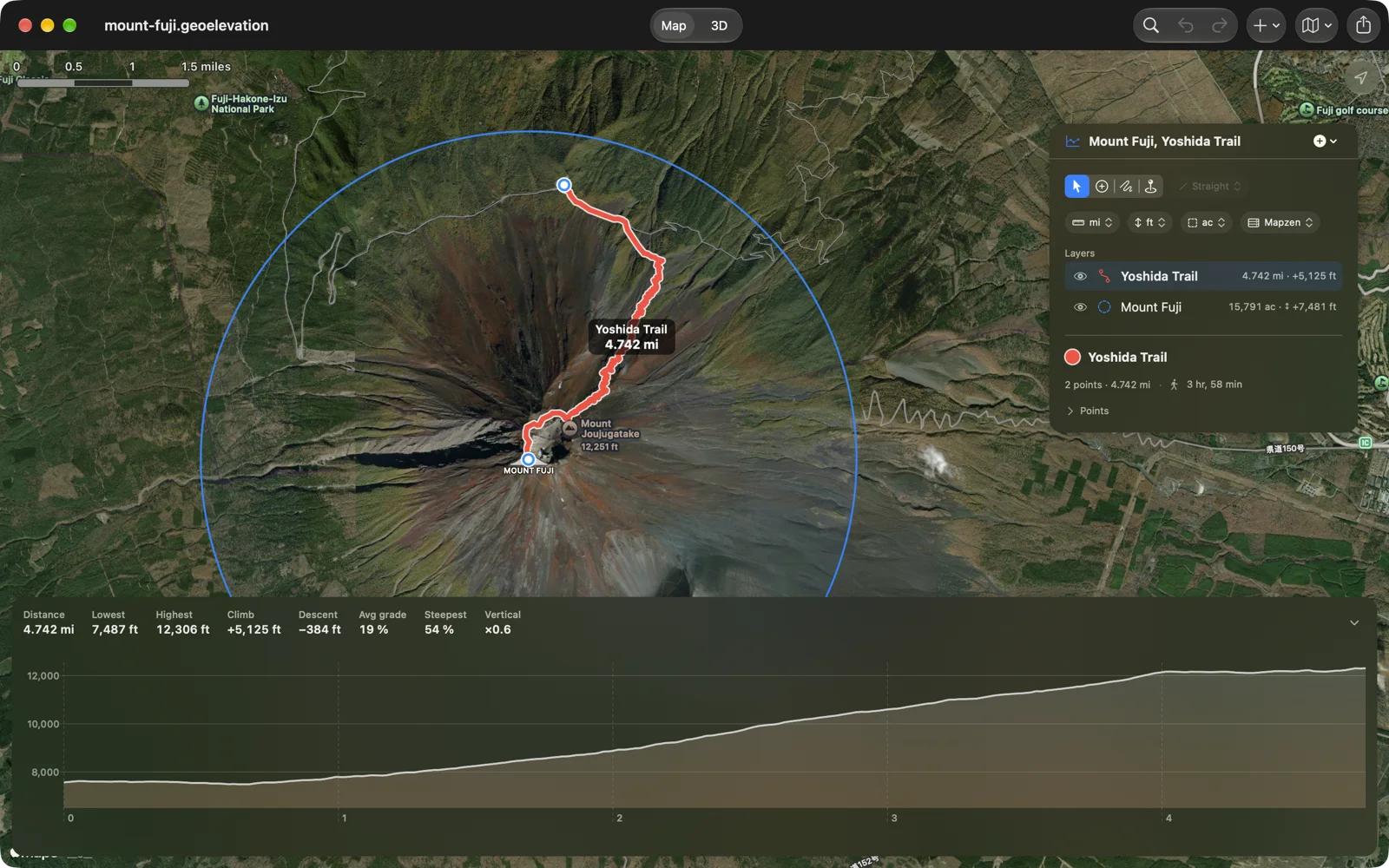
Choose Walking, Cycling or Driving beside the drawing tools, and every point you add is joined to the last along the real path or road. The Yoshida Trail above is a handful of points; Geo Elevation drew the switchbacks, and the profile under it is the climb you would actually make, not a straight line through the mountain. The points you placed are kept in the file, so the route opens the same way tomorrow, and a drag sends the leg along the road again.
Draw an area, read the ground
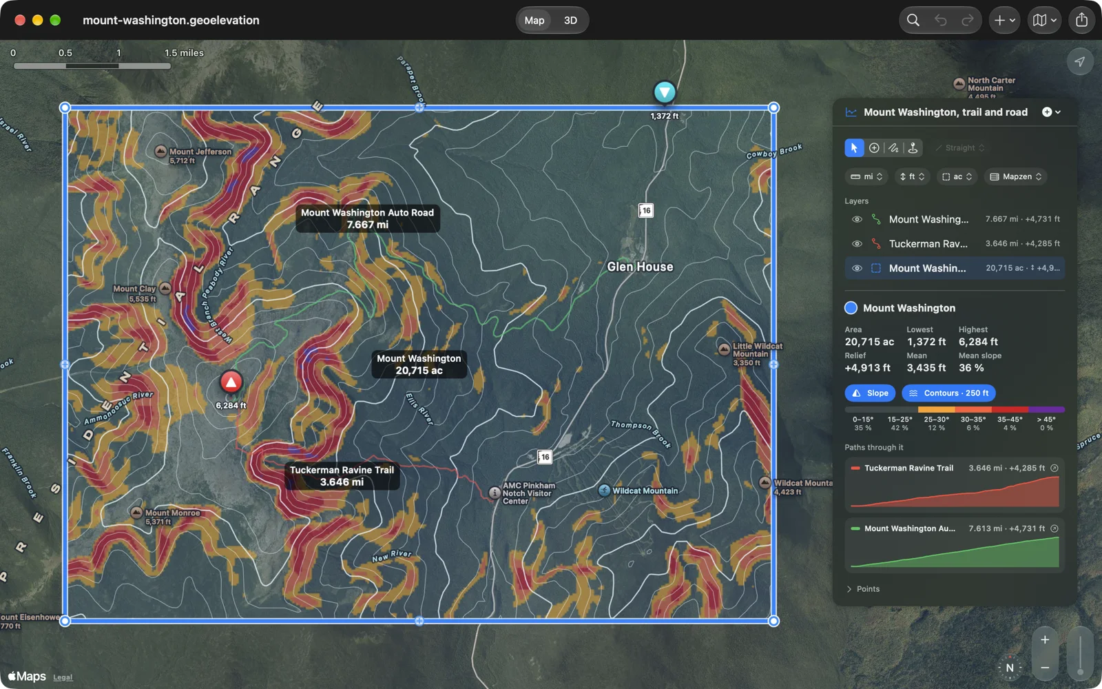
Draw an area, a circle or a rectangle, and the app reads the ground inside it every 30 metres from our own elevation server: the lowest, highest and mean height, the relief, the mean and the steepest slope, with the highest and lowest points marked on the map. Mount Washington above is 20,715 acres with 4,913 feet between its lowest corner and its summit.
Two layers sit on top. Slope colours the ground the way avalanche maps do, from 25 degrees up unless you choose otherwise, with the share of the area in each band. Contours draws lines at a spacing that suits the relief, every fifth one heavier. And every path that crosses the area is listed under it with a small profile of its own: scrub along the Tuckerman Ravine Trail and the Auto Road side by side, without leaving the area.
The ground in 3D
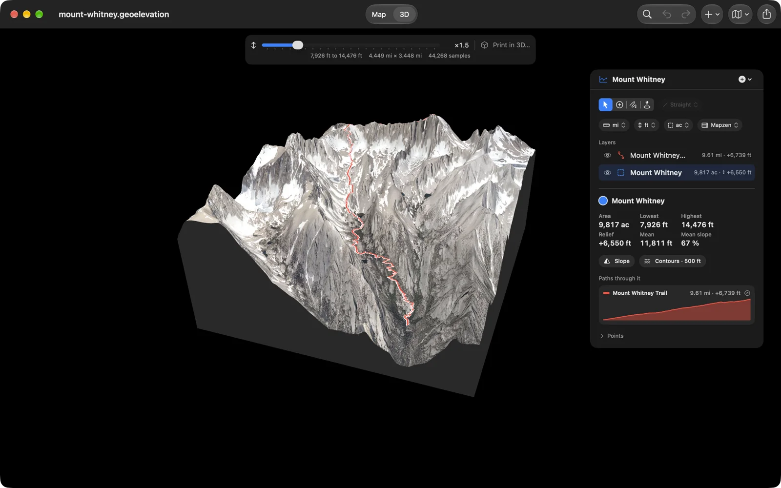
Switch to 3D and the area stands up as a block with the map draped over it, the slope and the contours on it if you want them, and every trail drawn on the surface. Scrub a trail’s profile and a marker climbs the mountain. The 3D view opens in a fraction of a second now, and the height slider stretches it as you drag.
On paper, or in plastic
Print gets a sheet of its own: the map or the 3D view exactly as you turned it, with or without the trails, the slope and the contours, and the profile, the numbers and the points below, with the page in front of you while you choose. Or save the ground as an STL file for a 3D printer, cut to the area’s outline on a flat base with the trails raised on it.
And
- Paths, areas, circles and rectangles are layers, like a drawing app’s: show, hide, reorder.
- Select never adds a point; Add Points draws; Freehand traces.
- Quick Look shows a document’s map and profile in the Finder and in Files.
- Settings for slope colours, contour spacing and how strong each layer is.
- In English, German, French, Spanish and Japanese, as before.
Geo Elevation is one purchase for iPhone, iPad, Mac and Apple Vision Pro, with no account and no subscription; if you bought the Mac-only edition years ago, all of this arrives in it as a free update. The Geo Elevation page has sample mountains to download, Mount Washington, Mount Fuji, Half Dome, Mount Whitney and the Dead Sea, ready to open.