Geo Elevation 2.0: the hill is no longer flat, and the terrain is in 3D
Geo Elevation went on the store in 2012 to answer one question: is this path hilly? Tap a few points on a map, get a chart of the ground under them. People have paid a couple of dollars for that answer ever since, hikers and cyclists and people wondering where the water will go, and the reviews over those years say the same two things. They like that it does one thing. And one complaint comes back year after year: “a 40-foot slope reads flat.”
They were right. The app took a hundred samples along the path whatever its length. On a two-kilometre walk that is one every twenty metres, which is fine; on a fifty-kilometre ride it is one every five hundred, and a hill that is over in three hundred metres is simply not there. Version 2.0 is the release where I sat down with every one of those reviews and the code, fixed that first, and then kept going.
A sample every 30 metres
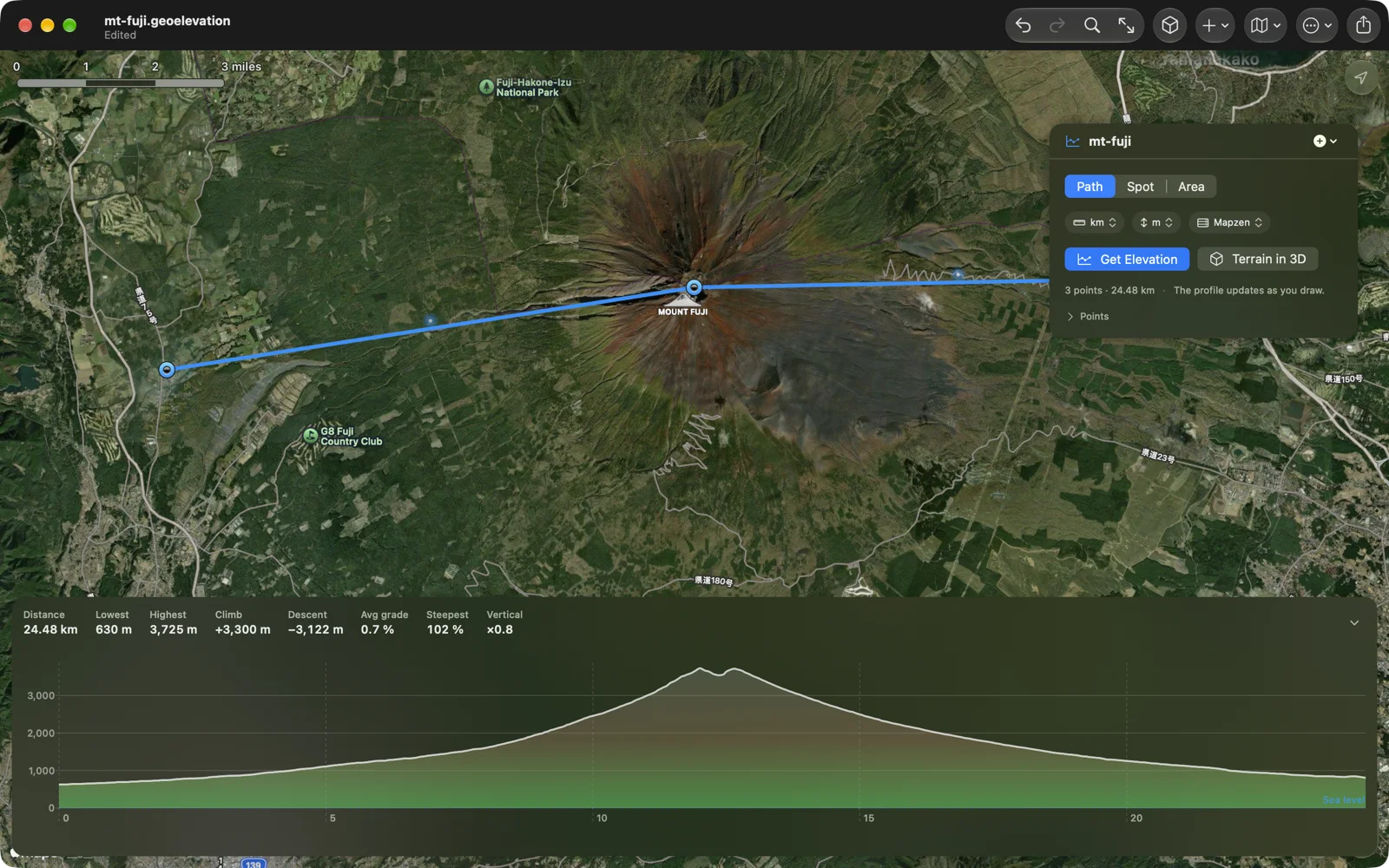
The path is now walked in 30-metre steps, the spacing of the elevation data itself, up to a thousand samples, and the pins you placed are always among them, so the profile passes through every point. The heights come from our own elevation server, ASTER and Mapzen at 30 metres, worldwide, and the profile fetches itself a second after your last edit: add a point, move a pin, and the chart dims and comes back. If the server has no height for a place, open ocean mostly, the chart shows a gap, not an error.
A chart that tells the truth
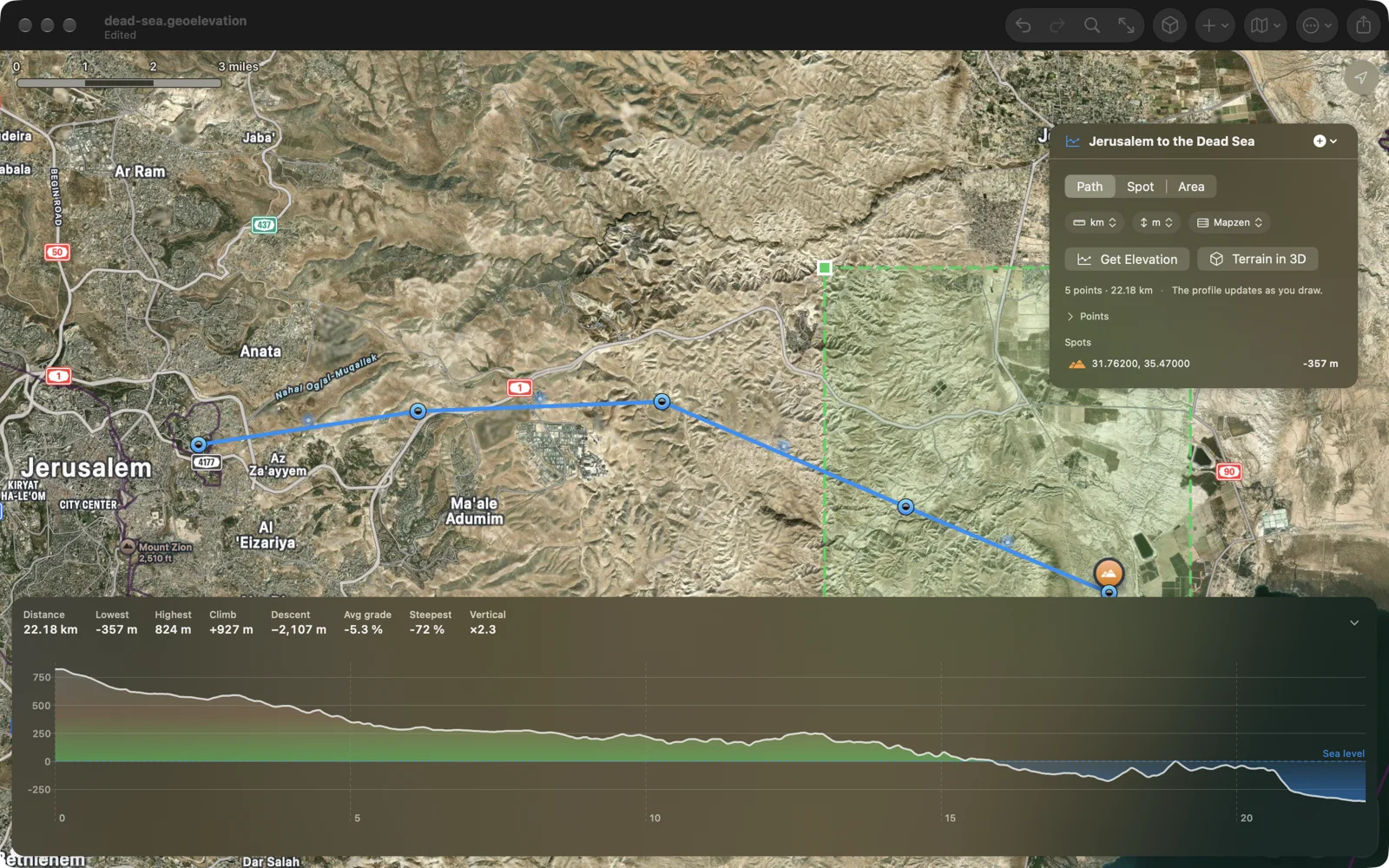
Sea level is a line on the chart now, and everything under it is water-blue, which is how a route from Jerusalem down to the Dead Sea should look: it ends 357 metres below the line. Above the chart: distance, lowest and highest, total climb and descent, the average grade and the steepest hundred metres. Hover or drag on the chart and a ring on the map shows where you are; pinch or drag across a climb to zoom into it, double-tap to see it all.
The terrain in 3D
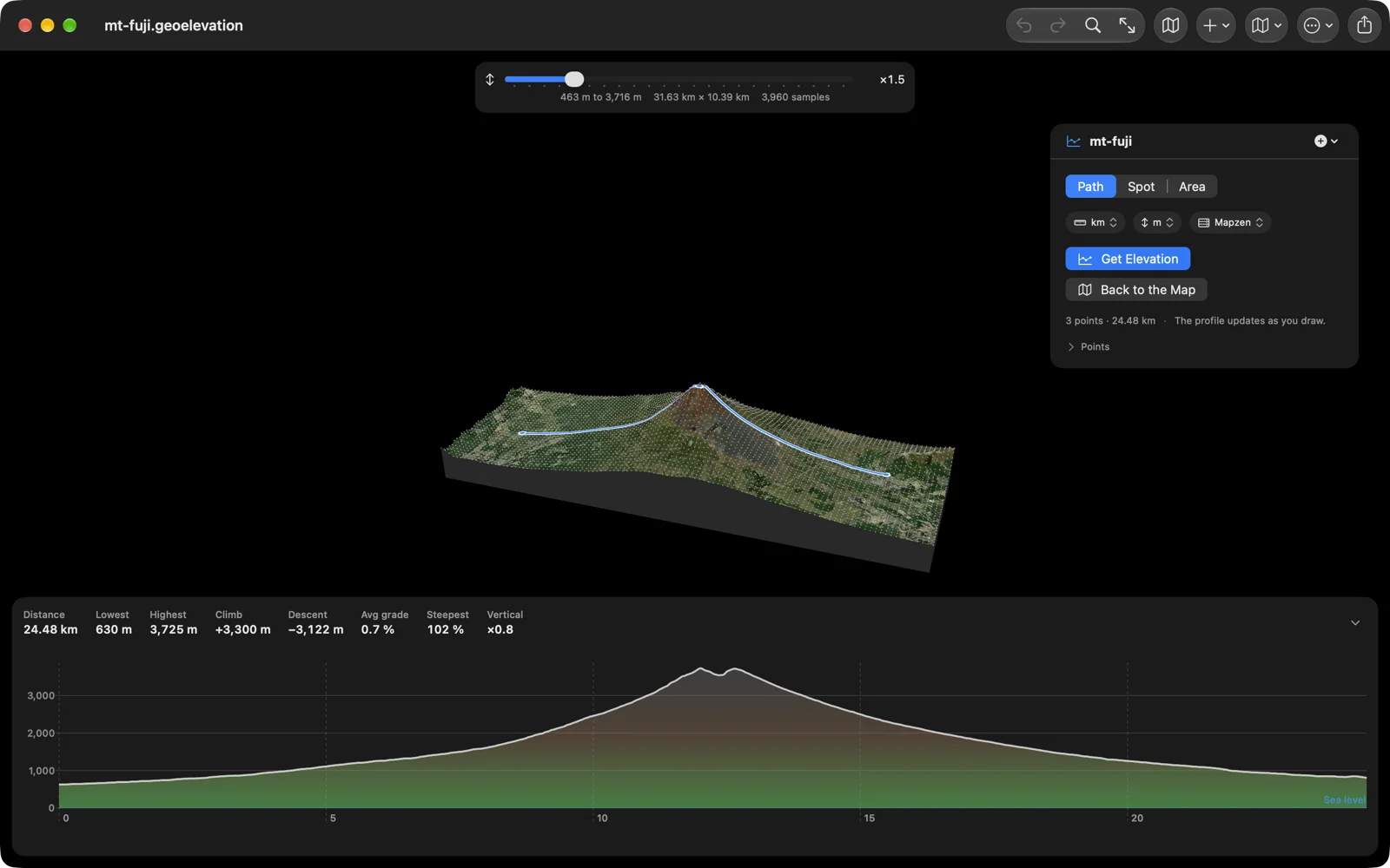
This is the part I did not plan. Once the app could ask the server for thousands of heights at once, the obvious next question was what the ground around the path looks like, not just under it. So one press samples a block around your path, thousands of points, and draws it as a surface with the satellite imagery on it and your path drawn on top. Turn it with a finger or the mouse, scroll to zoom, raise the exaggeration to make a gentle hill show, hover a sample to read its height. Move along the chart and a marker walks the surface.
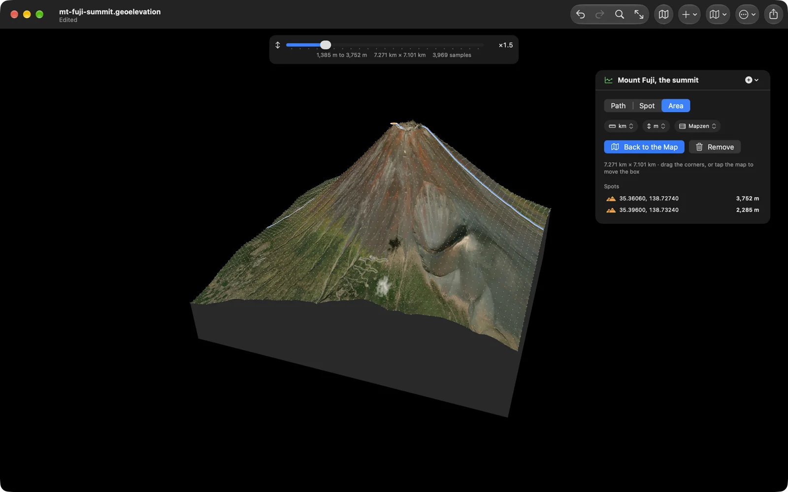
A path is a line, and a line has no edges, so there is also an Area mode: drag a box around the ground you care about, the summit or the valley, and the terrain shows just that. The picture above is the summit of Fuji, seven kilometres on a side, about four thousand samples. Nothing else on the store does this, as far as I can find. It is also what made me put the app on Apple Vision Pro, where a mountain you can turn in front of you makes a lot of sense.
Spot heights, and editing that works
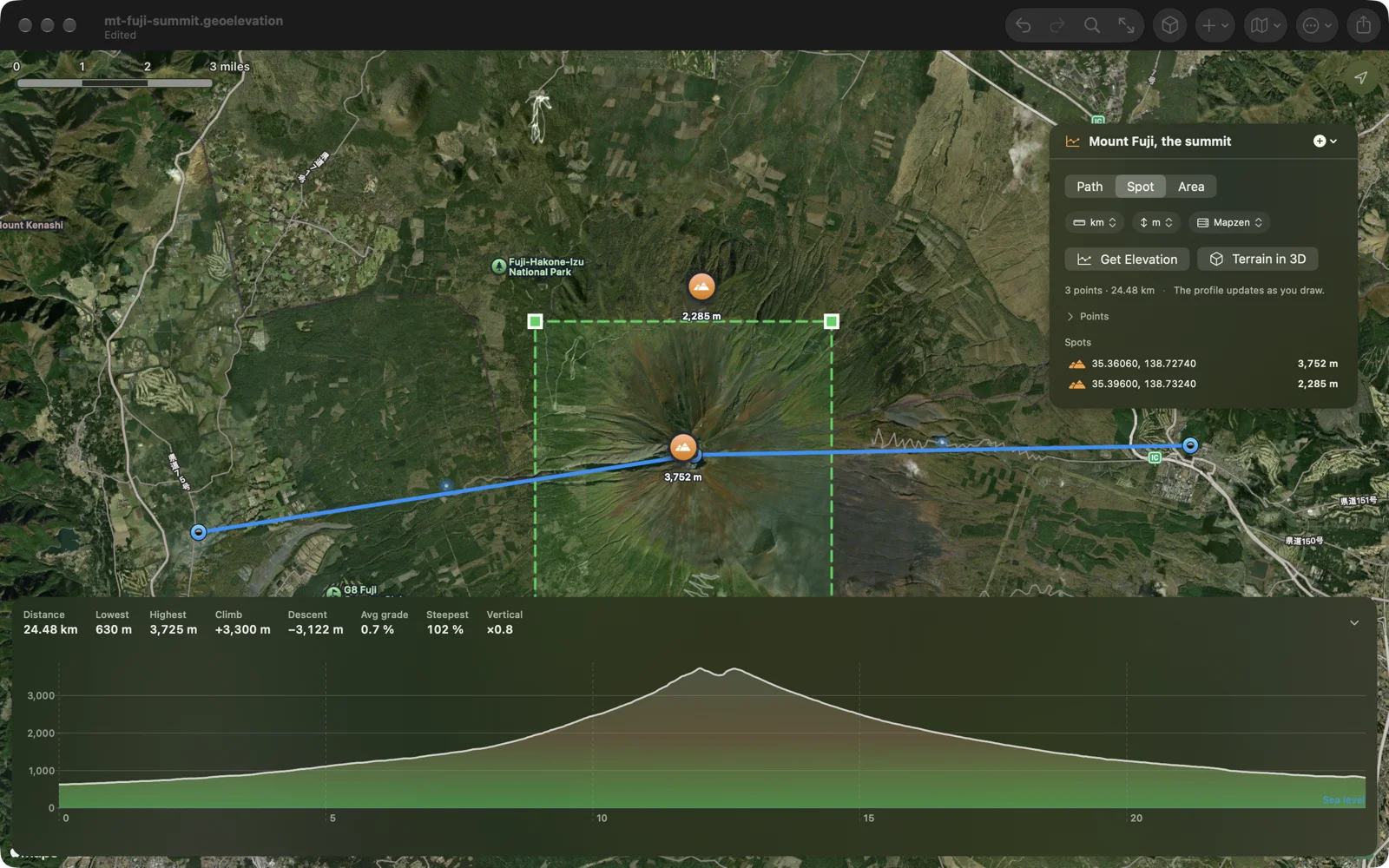
Tap anywhere for the height of that point; the spot stays on the map and in the list. And the editing is finally what it should have been: a pin drags with a loupe, tap a pin for its coordinate and height and delete it there, tap the dot on an edge to add a point, undo and redo every step, ⌘Z on the Mac. Type a coordinate to place a point exactly, or add the one where you stand.
In and out
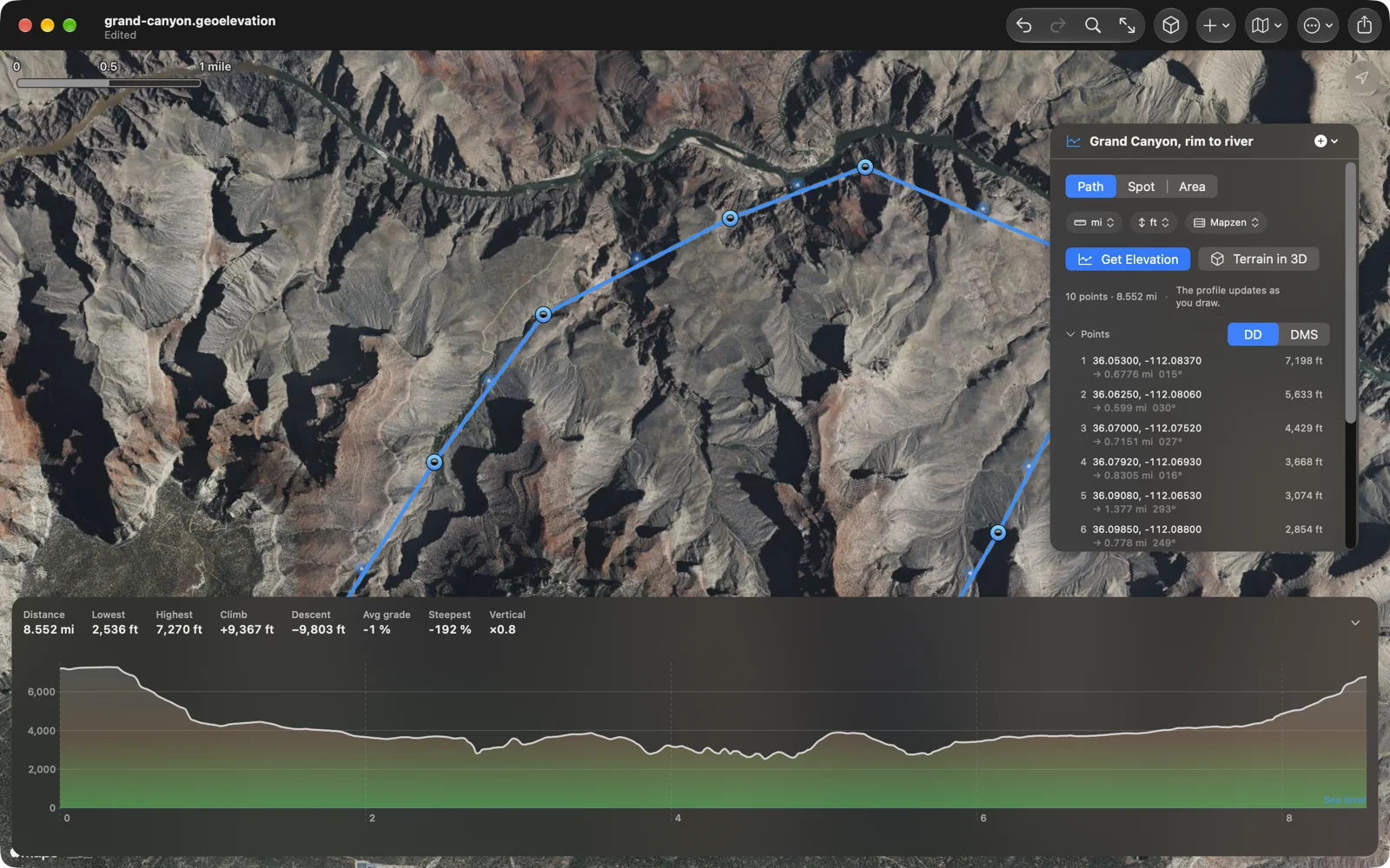
Import a GPX track, a KML route or GeoJSON, and the files of the older Geo Elevation for Mac. Export the profile as GPX with elevations, CSV, GeoJSON, an image, or a PDF report with the map, the numbers and every point; print from the Mac and from the phone. The document is plain GeoJSON with a version number, and each one remembers its own units and map style, so the Grand Canyon stays in feet.
A Mac app, five languages, and a price
The Mac build has documents in windows with autosave and versions, a Settings window, and a Path menu with shortcuts: ⌘1, ⌘2, ⌘3 for path, spot heights and area, ⌘E for the profile, ⌘⇧T for the terrain, ⌘F to search, ⌘0 to fit. Drop a file on the map to import it. The app and its listing are in English, German, French, Spanish and Japanese.
Geo Elevation 2.0 is one purchase for iPhone, iPad, Mac and Apple Vision Pro, and a free update if you already have it. The price goes from $1.99 to $4.99 with this version: the terrain is the feature nobody else has, and it runs on a server I pay for. No account, no subscription. The whole app is on its page, with sample files to try.