Geo Measure for Mac
Any area. Any distance. On a map, on your Mac.
How many acres is that field? How far is the walk to the station? How much fence does the new lot need? Geo Measure for Mac answers on a map: click the corners, read the number. It is the Mac-only edition of Geo Measure, sold on its own since 2013, and it is the same app: several shapes in one file, numbers computed on the same earth model surveying software uses, and the results out as KML, GPX, CSV or a PDF report.
Mac
One purchase. No account, no subscription.
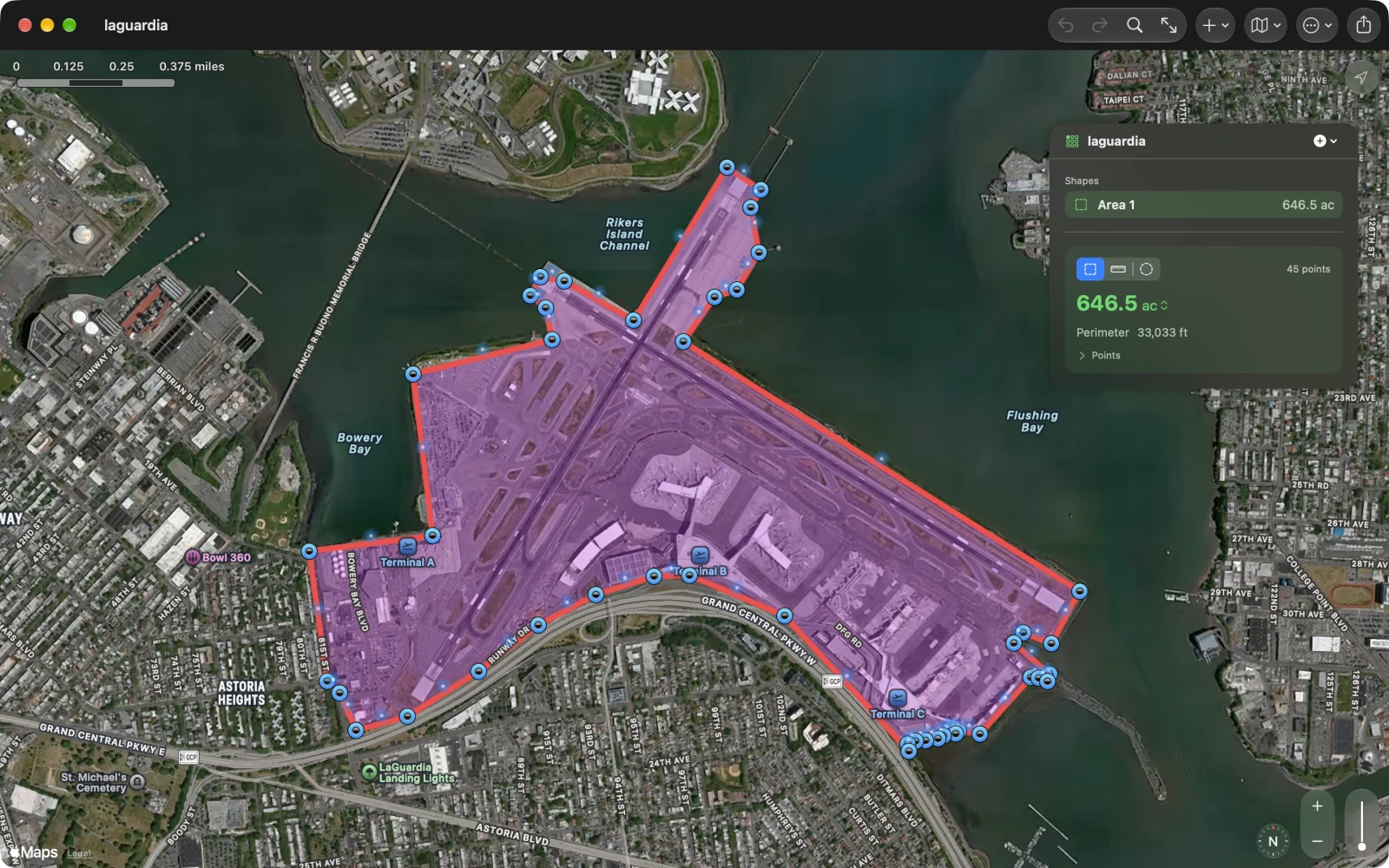
Click the corners. Read the number.
Click the map to drop a point, and again for the next corner. The outline closes itself and the number updates with every point. Drag a pin to move it, with a loupe that shows exactly where it sits. Click the small dot on an edge to bend the edge around a curve. Click a pin and delete it from its callout, or press ⌫. Every step is undoable with ⌘Z, and the outline warns you when it crosses itself.
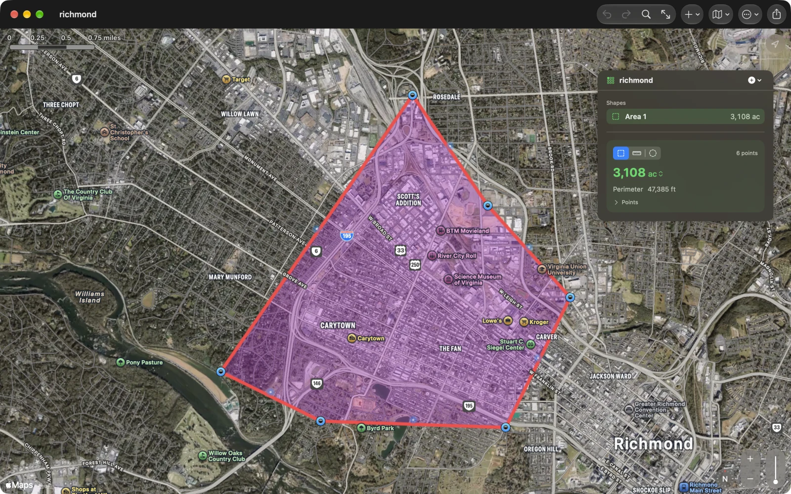
Along roads and paths
A straight line is the wrong answer for a walk. Pick Walking, Cycling or Driving and every click follows the paths and roads to it, the way you would really go, with Apple Maps’ travel time beside the distance. Drag a point and the route finds its way again; an area drawn along roads closes along them too. Straight lines are still one click away, and an area starts with them, because fields and lots are measured corner to corner.
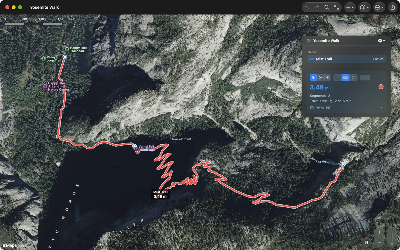
Areas, distances and circles, in one file
The north field, the fence line and the sprinkler’s reach belong together, so a document holds as many shapes as you like. Each one has a name and a colour, the list shows every shape’s number, and the totals add up at the bottom. Distances give you the length of every leg and its bearing; circles take a radius and give you diameter, circumference and area.
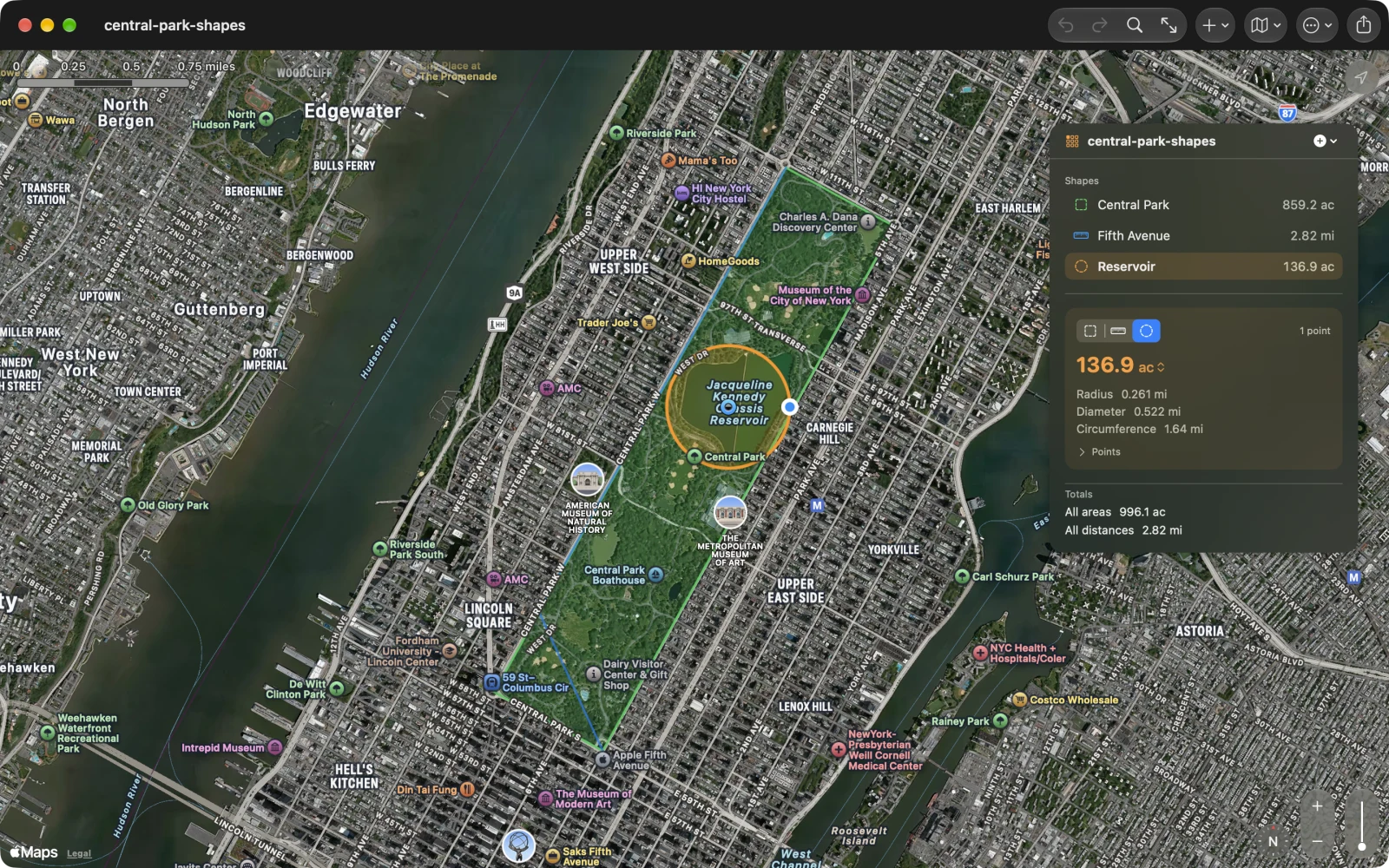
The right number
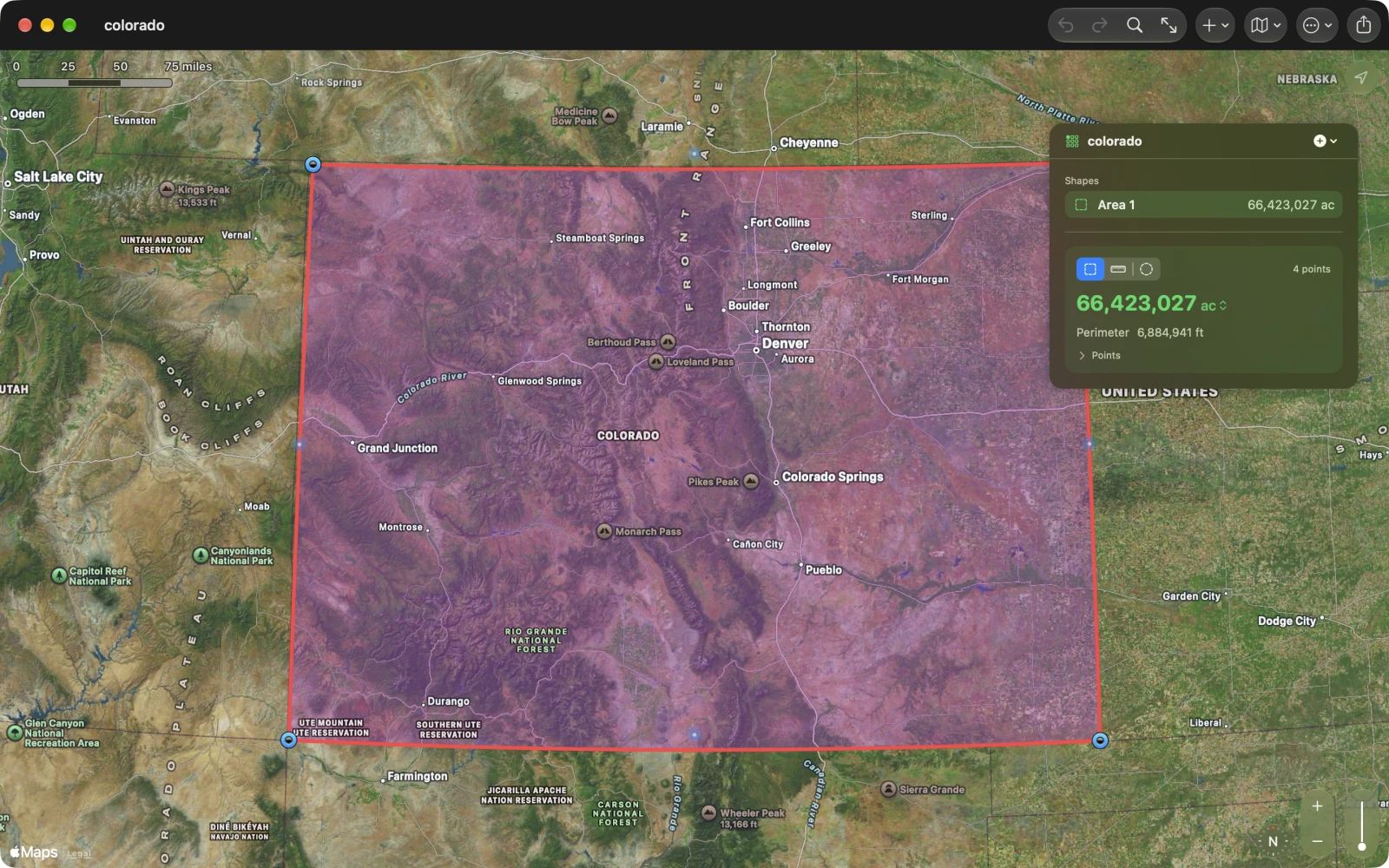
Areas and distances are computed on the WGS84 ellipsoid, the way surveying software does it, so a plot in Norway and a lot in Kenya are both right, and a state-sized quadrangle comes out within a hundredth of a percent of the geodesic answer. Acres, hectares, ares, square feet, square yards, square metres, square miles, square kilometres and tsubo; kilometres, miles, metres, feet, yards and nautical miles. The number shows the digits that mean something: four significant figures, whether it is 0.261 miles or 66,423,027 acres.
Every point, exactly
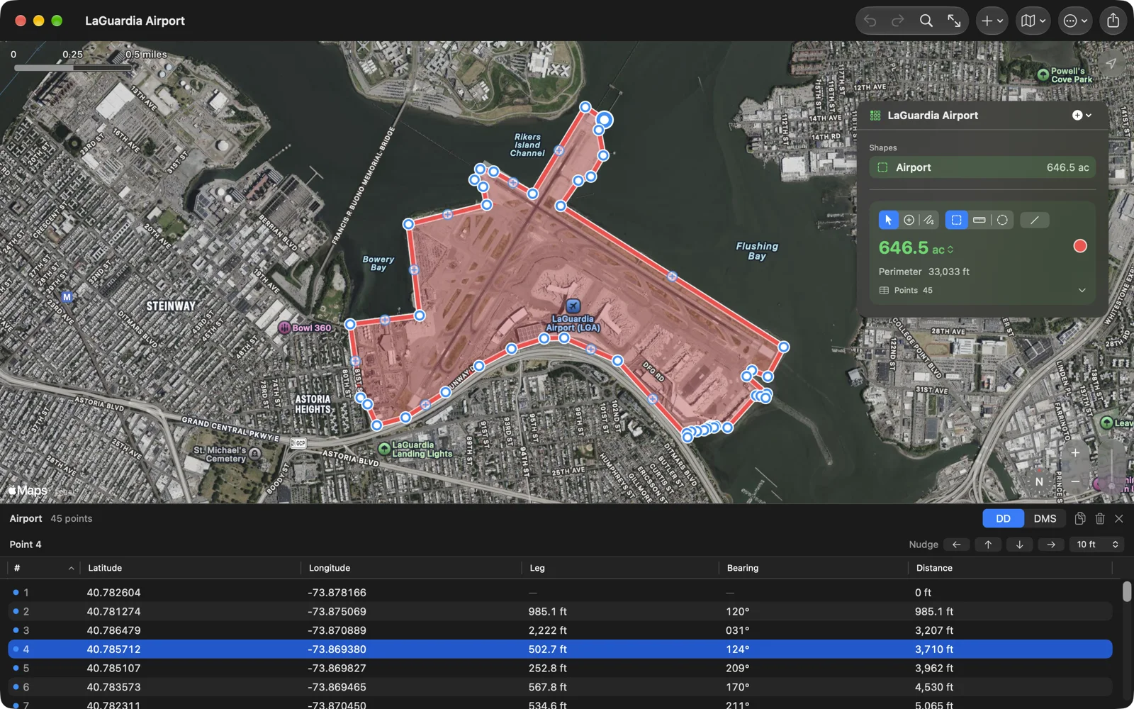
Open the points table under the map and every point is a row: its coordinates in decimal degrees or in degrees, minutes and seconds, the leg to it, its bearing and the distance so far. Pick a row and the map shows the point; pick a pin and the table scrolls to it. Type a new coordinate straight into the cell, nudge a corner north, south, east or west by a metre or a foot, delete several points at once, copy the lot to a spreadsheet. Add the point where you stand, or walk the boundary and let the phone drop a point every few metres.
In and out
Export GeoJSON, KML for Google Earth, CSV for a spreadsheet, GPX for a GPS, a PNG of the map, or a PDF report with the map, the numbers and every point, and print it with ⌘P. Import GeoJSON, KML and GPX: a parcel from a county GIS, a boundary from Google Earth, a track from a watch. Drop the file on the map and it is a measurement. Every .measure file this app has written since 2013 opens as it always did, and the document itself is GeoJSON, so anything that reads GeoJSON reads it.
Made for the Mac
Documents open in windows, autosave and keep versions. The menu bar has the whole app in it: ⌘1, ⌘2 and ⌘3 start an area, a distance or a circle, ⌘0 fits the map to the shapes, ⌘F searches for a place, ⌫ deletes the selected point, ⌘, opens the settings. Right-click a shape to rename or recolour it, and click the points list to jump to any corner. Standard, satellite, hybrid or 3D map, remembered per document. In English, German, French, Spanish and Japanese.
No file handy? Try these
Real documents, free to use. Download one and open it with Geo Measure for Mac.
- LaGuardia Airport: the airport’s outline in forty-five points, 646.5 acres.
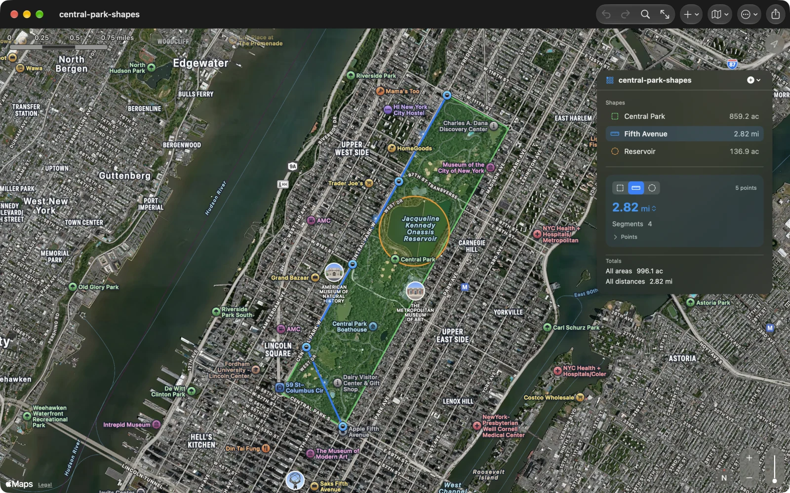
- Central Park, three shapes: the park as an area, Fifth Avenue as a distance, the reservoir as a circle.
- Richmond, Virginia: a six-point loop around the Fan and Carytown, 3,108 acres.
- Colorado: the four corners of a state, 66 million acres.
- Jaipur: a short route through the old city, as a distance.
Yours stays yours
Geo Measure for Mac has no account, no server and no tracking. Your measurements are files on your Mac, and in your iCloud Drive if you put them there. The only network traffic goes to Apple Maps: the map tiles it draws, the place search you type, and, when you measure along roads or paths, the points of each leg for directions. One purchase, no subscription, no in-app purchases.
Questions people ask
Which Geo Measure should I buy on the Mac? Either one: they are the same app with the same features, and they get the same updates. Geo Measure is one purchase for iPhone, iPad, Mac and Apple Vision Pro. Geo Measure for Mac, this page, is the edition we have sold on its own since 2013, for people who only want the Mac app or who already own it. If you own one of them, you have everything; nobody needs both.
I bought Geo Measure for Mac years ago. Do I pay again? No. Everything on this page comes to the app you own as a free update from the App Store, and it opens every file you made with it.
How do I measure the area of a field or a lot on a map? Open Geo Measure for Mac, find the place by search or by scrolling, and click each corner of the field. The area appears after the third point and updates as you add or move corners. Switch the unit on the number itself.
How accurate is it? The maths is the same as surveying software: distances by Vincenty’s formulae on the WGS84 ellipsoid, areas by spherical excess on the earth’s authalic sphere, checked against GeographicLib to a hundred-thousandth. The limit is where you put the pins, which on a satellite map at street zoom is a metre or so.
Can I get the shape into Google Earth or a GIS? Yes. Export KML for Google Earth, GeoJSON for QGIS and everything web, GPX for a GPS or a watch, CSV for a spreadsheet. Import works the same way round for GeoJSON, KML and GPX.
Does it work without a connection? The measurements do; the map needs a connection to load new tiles. Your files never need one.
Is there a web version? Yes, Geo Measure on geosq.com measures the same way in any browser, free. The app adds documents, several shapes, export and the Mac menus.
Can it measure along a road or a trail? Yes. Choose Walking, Cycling or Driving and the line follows the paths and roads between the points you click, with the travel time. Choose Straight for a line as the crow flies.
What changed lately? The newest work is written up in the 3.1 post.
Is there a manual? The Geo Measure guide covers every tool, menu, setting and Mac shortcut.