Geo Measure 3.1: along the trail, and every point exactly
Geo Measure has always measured the way a crow flies: tap two points and you get the straight line between them. That is the right answer for a field or a roof. It is the wrong answer for a walk. If you want to know how far it is to Vernal Fall, a straight line across the gorge tells you nothing, because nobody walks across the gorge.
Version 3.1 measures the way you would actually go.
See it in action
Recorded in the app. Interface shown in English.
Along roads and paths
Pick Walking, Cycling or Driving beside the drawing tools, and every tap follows the paths and roads to it. Beside the distance you get the travel time Apple Maps gives for that route. Drag a point and the route finds its way again; delete one and the two legs beside it join up along the road. Straight lines are still one tap away, and a new area starts with them, because fields and lots are measured corner to corner. The points you tapped are kept in the file, so the route opens the same way tomorrow.
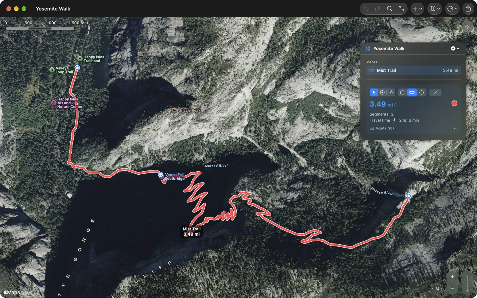
The Mist Trail above is three taps: the trailhead, the footbridge and the top of the fall. Geo Measure drew the switchbacks.
Every point, exactly
Surveyors, fence builders and people settling a boundary kept asking for the same thing: let me see the numbers and fix them. On the iPad, the Mac and Vision Pro there is now a table under the map with every point as a row: its latitude and longitude, the leg to it, its bearing and the distance so far. Pick a row and the map shows that point; pick a pin and the table scrolls to it. Type a new coordinate straight into the cell. Nudge a corner north, south, east or west by a metre or a foot and watch the area change. Select several points and delete them as one step, or copy the whole table into a spreadsheet. On the iPhone the same table opens as a sheet.
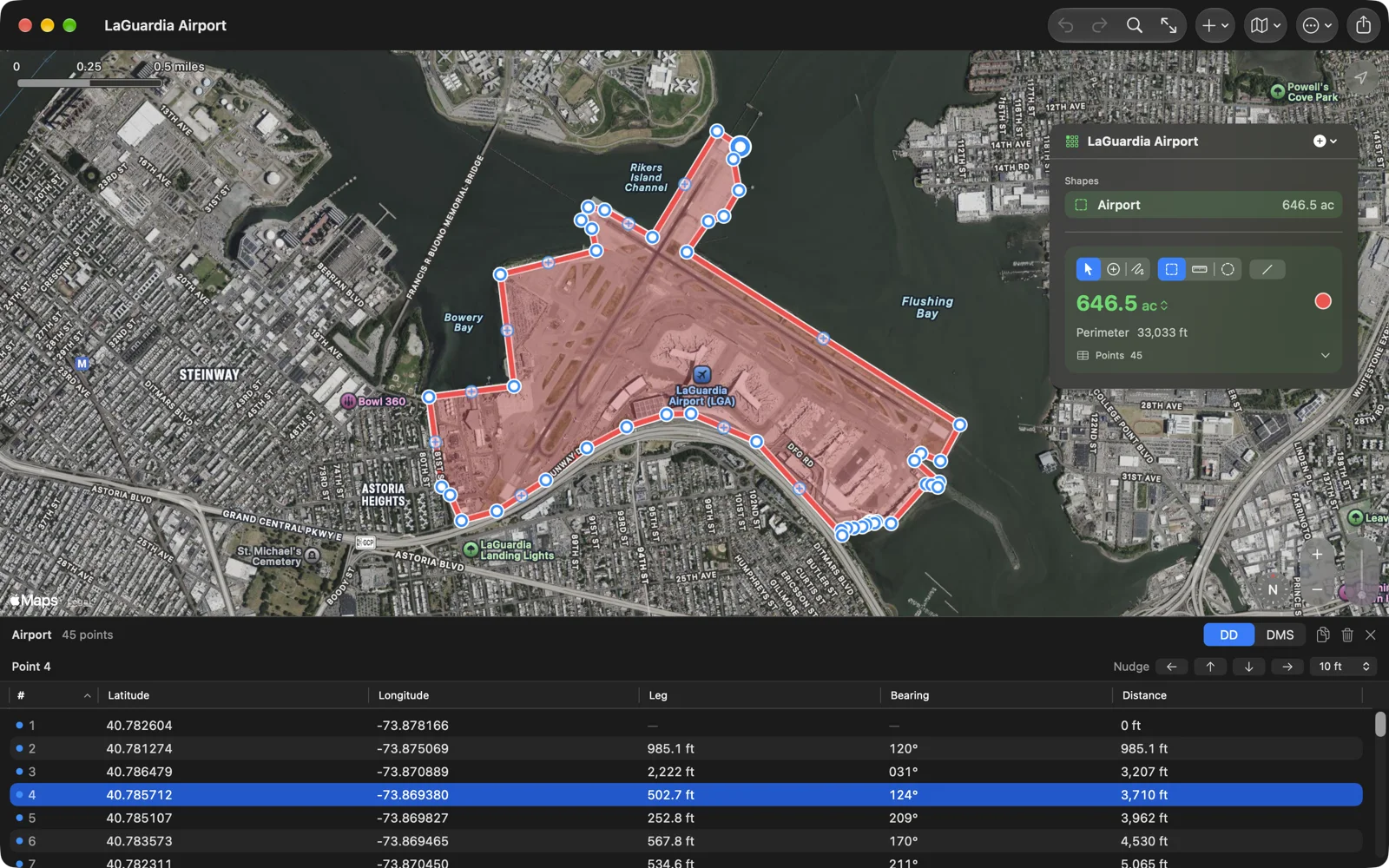
Select, Add Points, Freehand
The oldest complaint about Geo Measure is that you cannot move the map without adding a point. 3.1 gives you the choice. Select is for looking around and moving what is there; the map never adds a point. Add Points is for drawing. Freehand traces an edge with a finger, the Pencil or the mouse and turns it into corners. On the Mac they are ⌃⌘1, ⌃⌘2 and ⌃⌘3.
The rest
- On the iPhone the map fills the whole screen and everything else floats on it in glass.
- Settings can write each shape’s name and value on the map, and the length of every side.
- Numbers show four significant figures by default and up to six if you need them.
- Double-click a shape in the list to fit it on the map.
Geo Measure 3.1 is on the App Store for iPhone, iPad, Mac and Apple Vision Pro, one purchase for all of them, in English, German, French, Spanish and Japanese. The Geo Measure page has the details and sample files, including the Mist Trail walk.