Geo Measure 4.0.1: holes in areas
Fields have ponds. Lots have courtyards. A parcel has the house on it, and the acres you farm or mow or fence are the parcel less the house. Until now an area in Geo Measure was one outline, so a field with a pond measured the pond too, and a file from a county GIS that drew the pond as a hole came in a little too large. 4.0.1 fixes both.
Draw the hole
Select the area and choose Add a Hole from the + menu (on the Mac, Measure › Add a Hole, or right-click the area under Layers). Tap inside the area to start the hole, tap its corners, and choose End Hole. The number drops by the hole, the map leaves the hole empty, and the perimeter counts the hole’s edge as well, the way a GIS does. A corner tapped outside the area is refused, and a hole with fewer than three corners is thrown away rather than kept half-drawn.
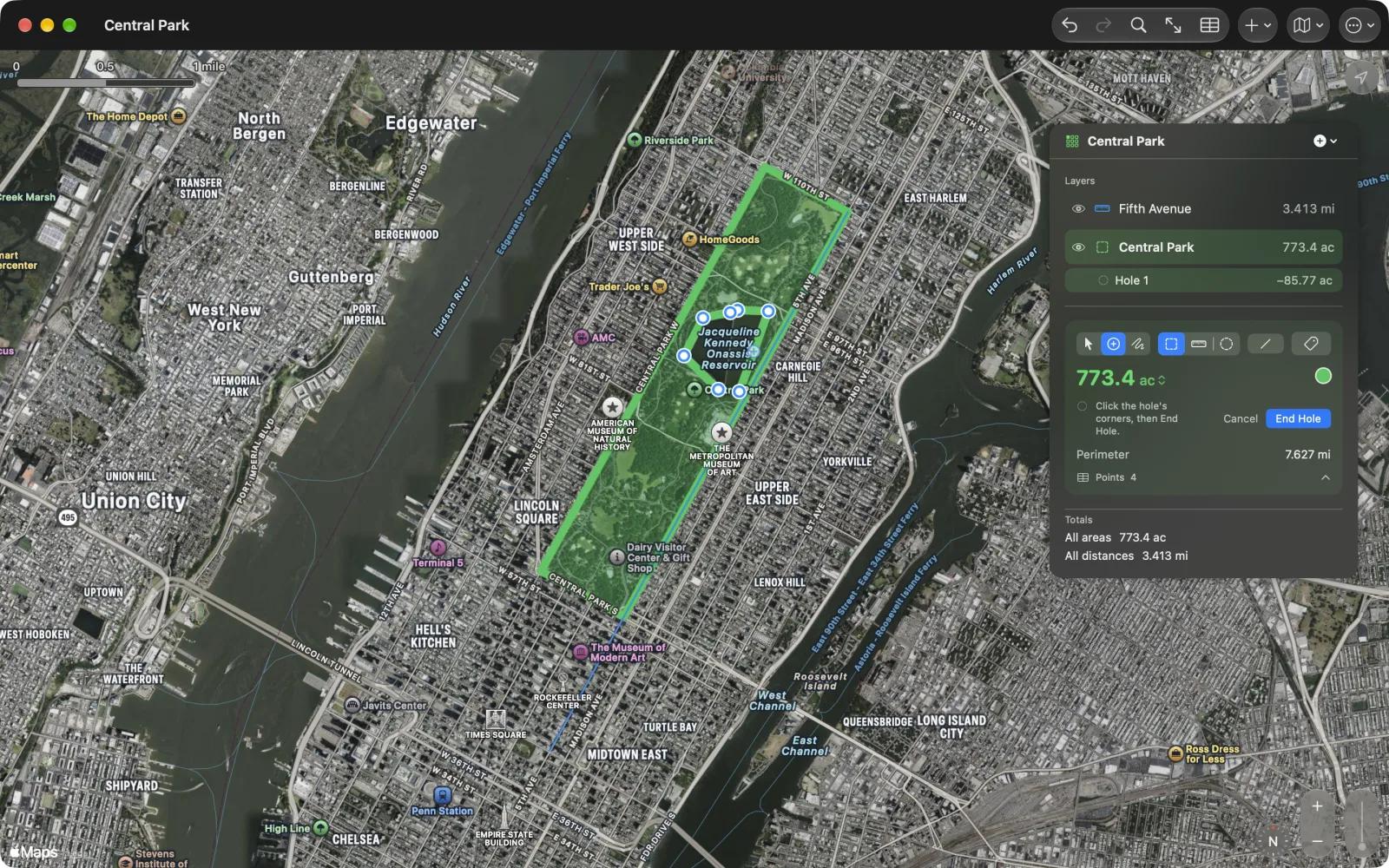
Layers is a tree now
Each hole is listed under its area in Layers, indented, with its own size as a negative number. Tap a hole’s row and its corners get the pins: move them, add one on an edge, delete one, or type a coordinate in the points table, exactly as for the outline. Delete Hole is in the row’s menu. On the map, a tap on a hole’s edge picks it the same way, and Outline takes you back.
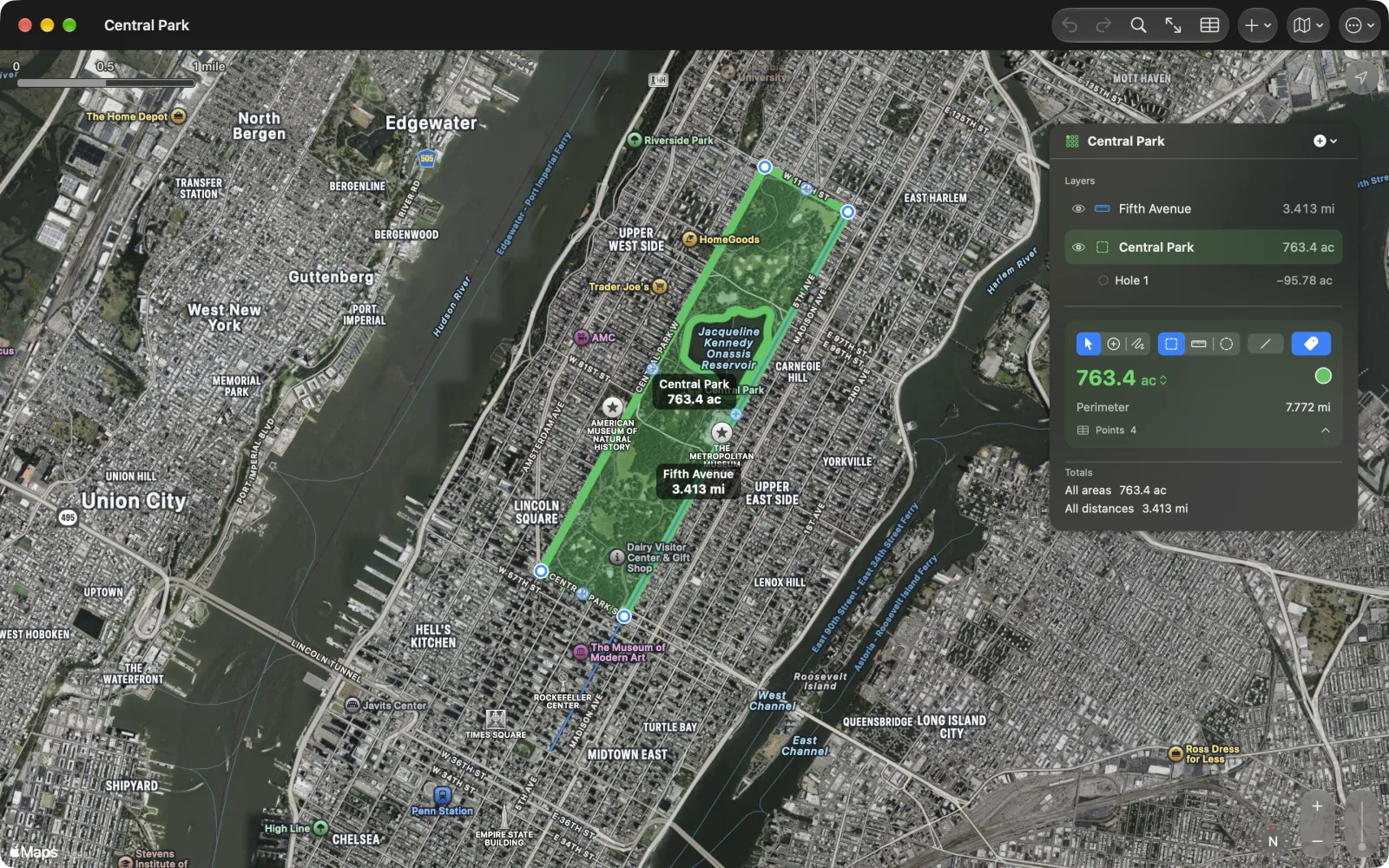
Holes in and out
A polygon with inner rings in a GeoJSON file, or inner boundaries in a KML file, now comes in with its holes, and every export carries them out again: as inner rings in GeoJSON, inner boundaries in KML, rows of their own in CSV, and a route of their own in GPX. The document itself has always been GeoJSON, which has had holes in polygons since the first draft of the standard, so a Geo Measure file with holes opens in QGIS, Google Earth and the rest as it should. Our own KML Explore reads and writes the same holes, and a file with holes still opens in Geo Measure 4.0, which measures the outline alone.
4.0.1 is a free update for iPhone, iPad and Mac, and for Geo Measure for Mac.