Geo Measure 3.0: any area, any distance, and the right number
Geo Measure is the oldest app I still sell. It went on the store in 2011 to answer one question, how many acres is that field, and people have kept paying a few dollars for that answer for fifteen years: farmers, roofers, fence contractors, real-estate agents, people in Japan measuring in tsubo. The reviews over those years say the same two things. They like that it is simple. They wish they could delete a point.
Version 3.0 is the release where I sat down with every one of those reviews and the code and fixed what they were asking for, and then kept going.
Delete a point. Undo anything.
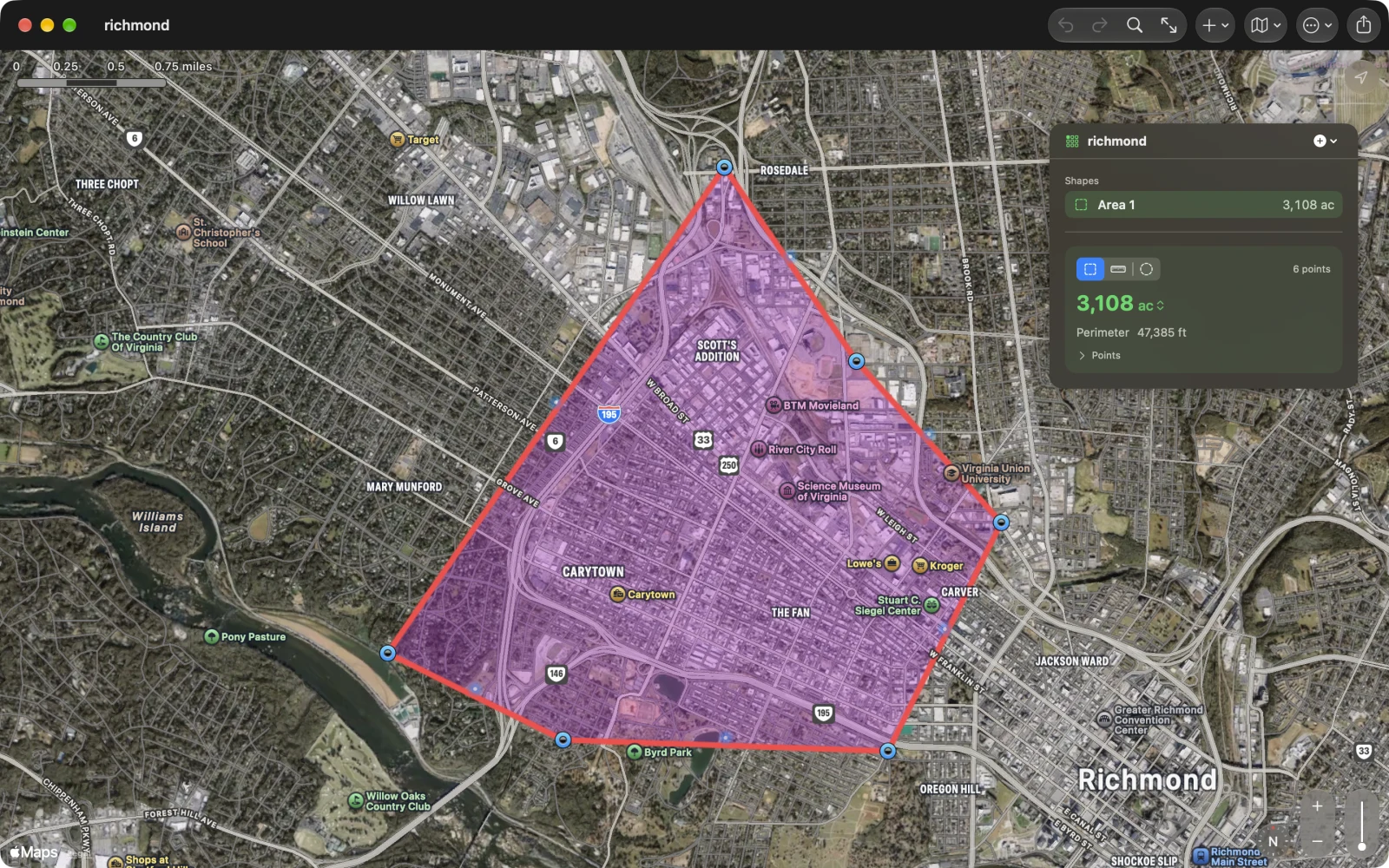
Tap a pin and its callout has a Delete button. Drag a pin and a loupe shows you exactly where it is going. Tap the small dot in the middle of an edge to bend that edge around a curve. Every one of those is an undo step, on the Mac with ⌘Z and on the phone with the arrows, and a whole drag is one step, not a hundred. Type a coordinate to place a point exactly, in decimal degrees or in degrees, minutes and seconds, in whatever form you paste it. Add the point where you are standing. Or start walking and let the phone drop a point every few metres until you are back where you began.
Several shapes in one file
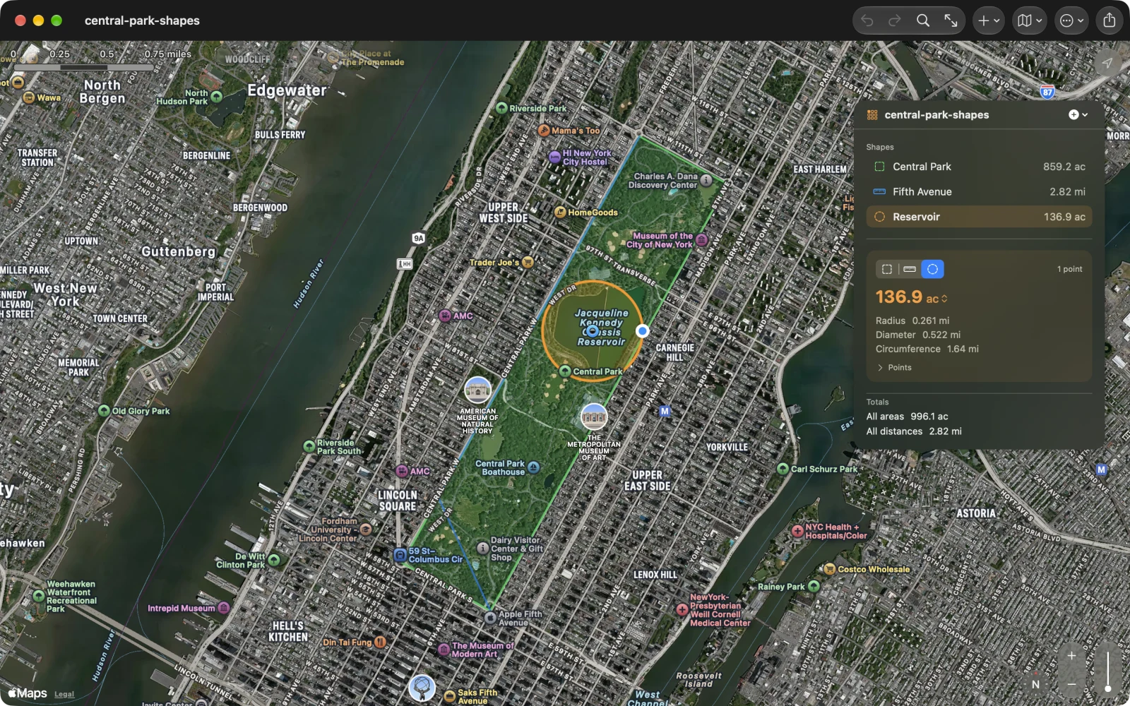
A document used to hold one shape. It now holds as many as you need, each with a name and a colour, listed with its number, and the totals at the bottom. There is a third kind of shape, the circle: a centre and a radius, with diameter, circumference and area. The picture above is Central Park as an area, Fifth Avenue as a distance and the reservoir as a circle, in one file.
The right number
I rewrote the maths. Distances are now Vincenty’s formulae on the WGS84 ellipsoid, areas are spherical excess on the earth’s authalic sphere with the latitudes mapped so the result matches the ellipsoid, and both are tested against GeographicLib’s published values. The practical differences: a nautical mile is now a nautical mile (it was off by a few percent), a plot at 60° north is as accurate as one at the equator, and the number shows four significant figures instead of a fixed two decimals, so a small lot reads 0.261 acres and a state reads 66,423,027 acres. The outline also tells you when it crosses itself, because a bow-tie has no area worth reporting.
Every point, written down
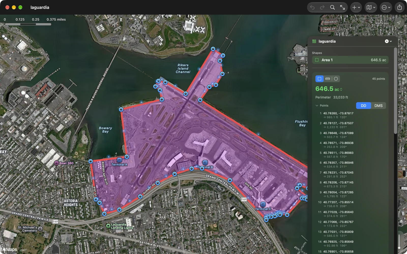
The panel lists every point with its coordinates and the length and bearing of the leg to the next one, in decimal or DMS. On the phone the point count on the card opens the same list as a sheet over the map. Click a row and the map goes there.
In and out
The document is GeoJSON, with a version number, and it opens every file the app has ever written plus the documents of the older Geo Measure for Mac. Export gives you GeoJSON, KML for Google Earth, CSV for a spreadsheet, GPX for a GPS, a PNG of the map, or a PDF report with the map and every point on Letter or A4, and both the Mac and the phone print it. Import takes GeoJSON, KML and GPX, so a county parcel or a track from a watch becomes a measurement. On the Mac you can drop the file on the map.
A Mac app, not a phone app on a Mac
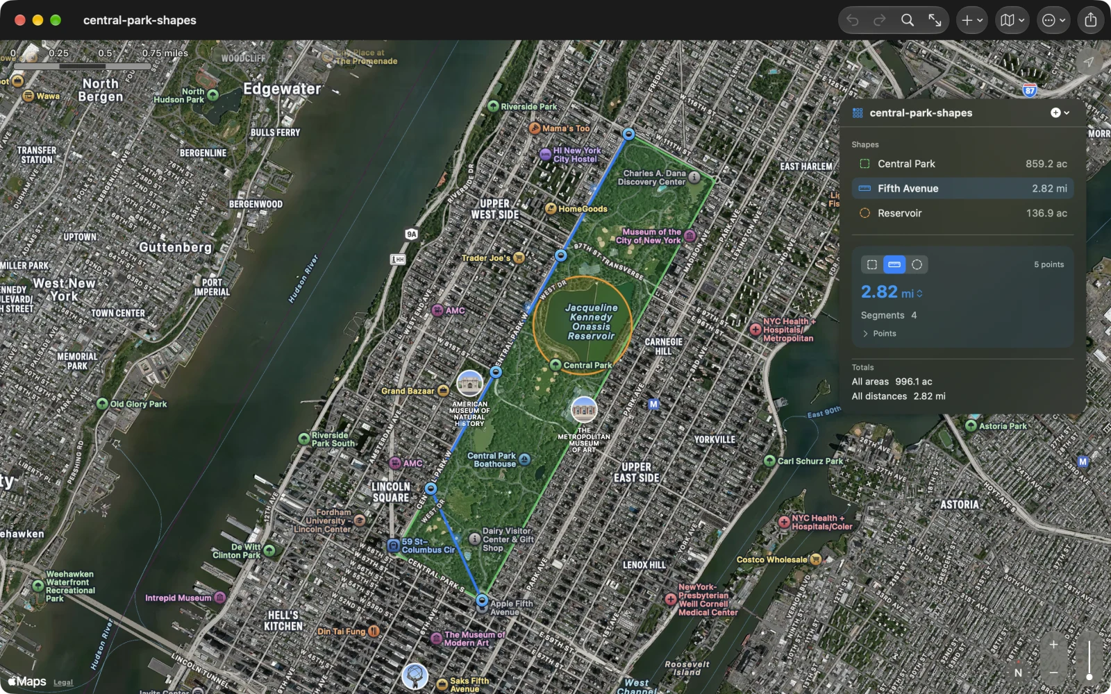
The Mac build used to be the iPad app in a window. It now has documents in windows with autosave and versions, a Settings window on ⌘,, and Measure and View menus with shortcuts: ⌘1, ⌘2, ⌘3 for a new area, distance or circle, ⌘0 to fit, ⌘F to search, ⌫ to delete the selected point. The first window opens at a useful size. The map can be standard, satellite, hybrid or the 3D flyover, and the choice is remembered.
Five languages, and a test suite
The app and its store listing are in English, German, French, Spanish and Japanese, which between them cover most of the people who buy it. Behind the scenes the release has what the app never had: a unit-test target that pins the geometry to GeographicLib’s numbers and round-trips every document format, and UI tests that tap, drag, delete and undo for real in the simulator. Two of the bugs above were found by those tests, not by me.
Geo Measure 3.0 is one purchase for iPhone, iPad, Mac and Apple Vision Pro, and a free update if you already have it. It has no account, no server and no subscription; your measurements are files on your device. The whole app is on its page, with sample files to try.