GPX Explore
Visualize your outdoor adventures with GPXExplore, a lightweight and intuitive GPX track viewer for iOS.
View your hiking, cycling, running, and other GPS tracks with our elegant elevation-based gradient coloring that instantly shows climbs and descents. Open any standard GPX file to see your routes displayed on an interactive map with comprehensive statistics.

Screenshots
iOS
Beautiful design with full support of dark mode. Scroll the elevation chart to see the elevation point on the map. Files that are sent via messages, email or any other app that generates GPX could be opened by GPX Expore on iOS.
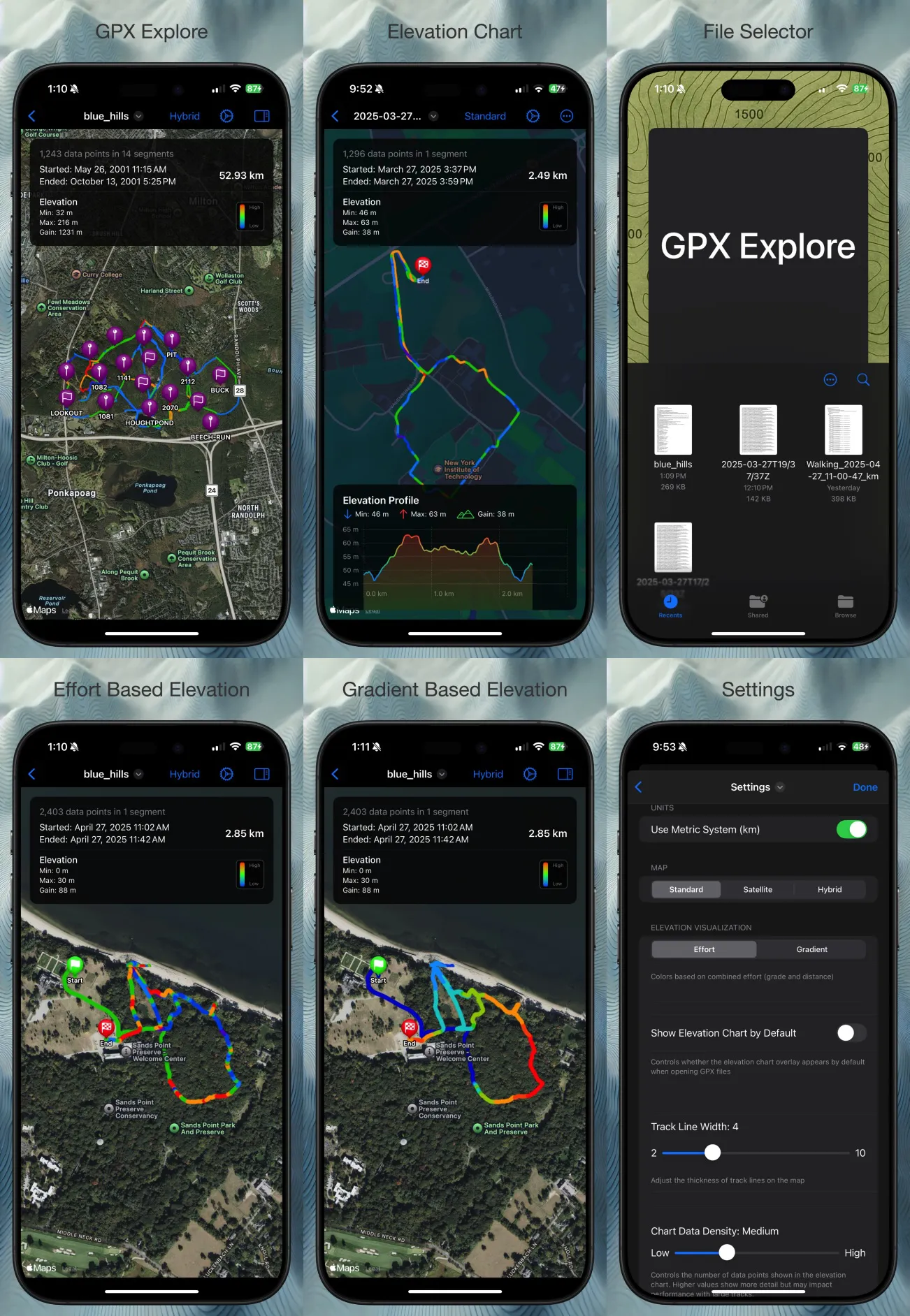
Provides 2 types of elevation modes. One is based purely on elevation gradient, the other is based on effort.
Mac
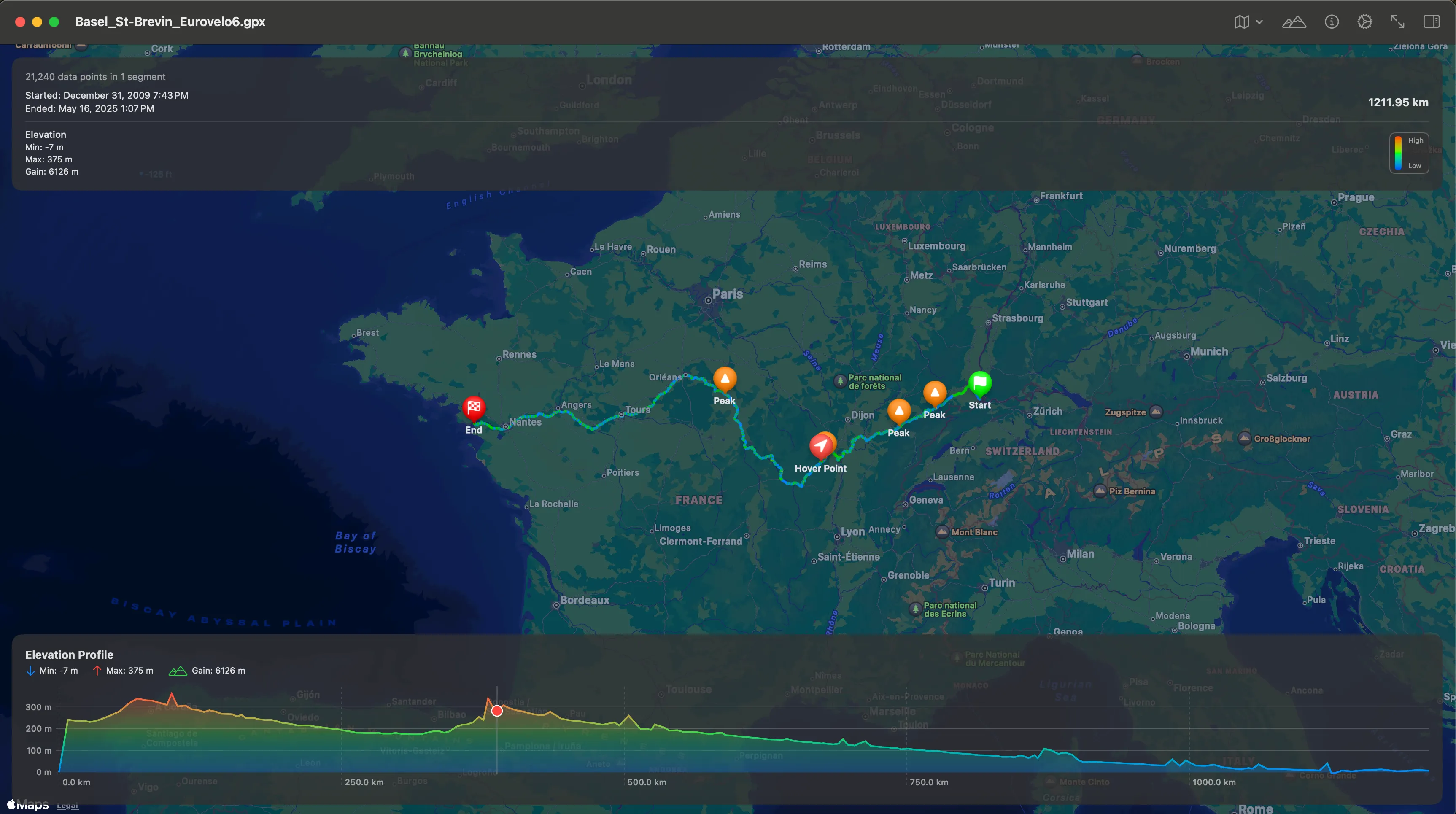
View elevation and waypoints. Hover animation to show the elevation point on the map.
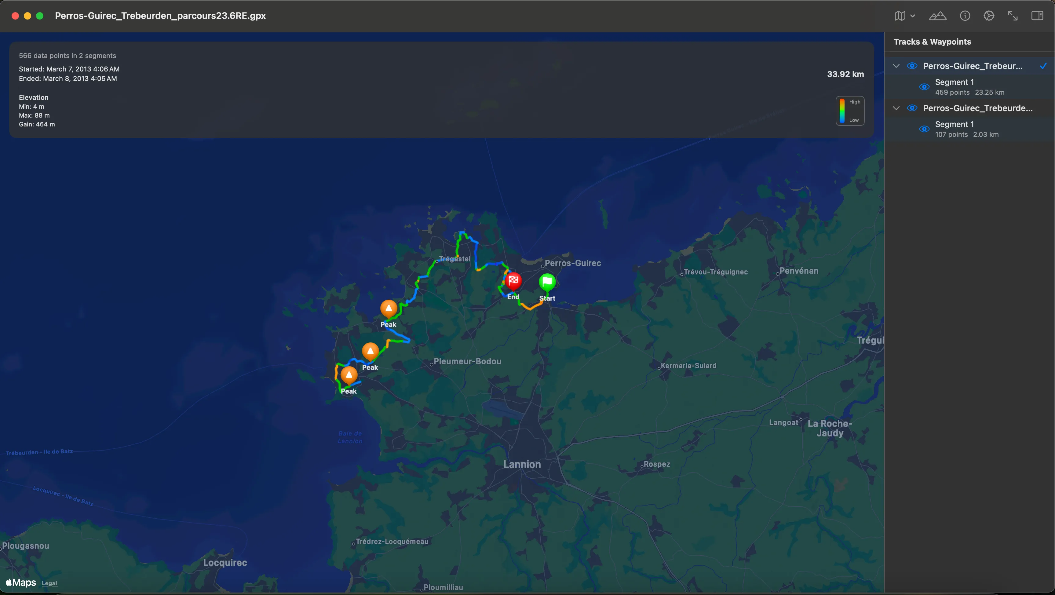
Side drawer to show you segments and way points. Each track, segment and way point can be hidden or shown.
Features
-
Simple, read-only GPX file viewer
-
Intuitive map interface with elevation visualization
-
Color-coded tracks based on elevation changes
-
Detailed route statistics
-
Universal app for iPhone, iPad, and Mac
Perfect for outdoor enthusiasts who want to revisit their adventures or plan new ones using existing GPX tracks.