Geo Elevation for Android Released
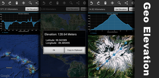
We just released Geo Elevation App for Android! This app let you draw a path by touching screen, and you can generate a “Cross-Section” elevation chart. This is some sort of side-view when you cut through the object. For example, if you are wondering how Mt. Fuji looks like from the side, draw the pass across the peak, then simply hit “Get Elevation” button. Not only for study usage, but also this is useful for biking or jogging. Draw a path through your favorite training routes, then the app will tell you the hilly areas v.s. flat area in the comprehensive chart.
Unlikely other elevation app, you can drop the pin anywhere you want, then find out the elevation right away. The app also allows you to export the data in various formats, such as KML, CSV, summary text, image, and so on.
Get this app while it is promotional price.

 Download Geo Elevation for Android NOW!